module 9 The Unequal Heating of Earth
The unequal heating of Earth by the Sun is a major driver of the climates found around the world. To understand how this unequal heating occurs, we need to examine the makeup of Earth’s atmosphere. We can then investigate how the angle of sunlight striking Earth affects the area over which the Sun’s energy is spread, and the ability of different regions of the world to absorb this energy. Finally, we must consider how the tilt of Earth on its axis affects the energy received from one season to another throughout the year.
Learning Objectives
After reading this module you should be able to
identify the five layers of the atmosphere.
discuss the factors that cause unequal heating of Earth.
describe how Earth’s tilt affects seasonal differences in temperatures.
Earth’s atmosphere is composed of layers
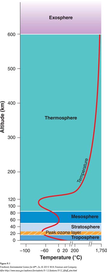
As FIGURE 9.1 shows, Earth’s atmosphere consists of five layers of gases. The pull of gravity on the gas molecules keeps these layers of gases in place. Because each layer of gas has mass, the layers closest to Earth have a greater mass of air above them. This causes the layers closest to Earth to have more densely packed molecules, which causes higher air pressure.
Troposphere A layer of the atmosphere closest to the surface of Earth, extending up to approximately 16 km (10 miles).
The atmospheric layer closest to Earth’s surface, the troposphere, extends roughly 16 km (10 miles) above Earth. It is the densest layer of the atmosphere and it is the layer where most of the atmosphere’s nitrogen, oxygen, and water vapor occur. The troposphere experiences a great deal of circulation of liquids and gases, and it is the layer where Earth’s weather occurs. Air temperature in the troposphere decreases with distance from Earth’s surface and varies with latitude. Temperatures can fall as low as –52°C (–62°F) near the top of the troposphere.
Stratosphere The layer of the atmosphere above the troposphere, extending roughly 16 to 50 km (10–
Above the troposphere is the stratosphere, which extends roughly 16 to 50 km (10–
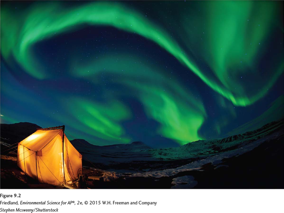
Beyond the stratosphere are the mesosphere, the thermosphere, and the exosphere. The atmospheric pressure and density in each of these layers continues to decrease as we move toward the outer layers of the atmosphere. The thermosphere is particularly important to organisms on Earth’s surface because of its ability to block harmful X-
The amount of solar energy reaching Earth varies with location
Now that we know something about Earth’s atmosphere, we can take a closer look at the processes that affect heat and precipitation distribution. As the Sun’s energy passes through the atmosphere and strikes land and water, it warms the planet’s surface. But this warming does not occur evenly across the planet. This uneven warming pattern has three primary causes.
The first cause of unequal warming is variation in the angle at which the Sun’s rays strike Earth. As we can see in FIGURE 9.3, in the region nearest to the equator—
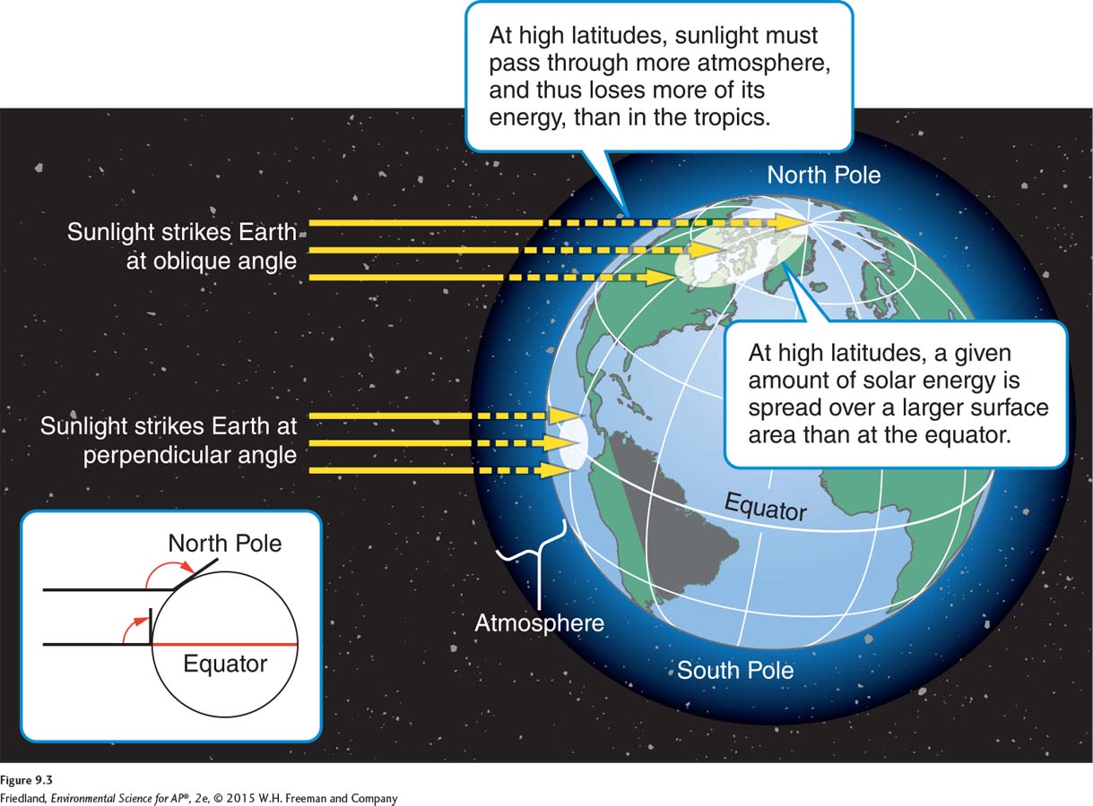
The second cause of the uneven warming of Earth is variation in the amount of surface area over which the Sun’s rays are distributed. As you may know, the Sun’s rays strike Earth at different angles in different places on the globe, and the angle can change with the time of year. When the Sun’s rays strike near the equator, the solar energy is distributed over a smaller surface area than near the poles. Thus, regions near the equator receive more solar energy per square meter than mid-
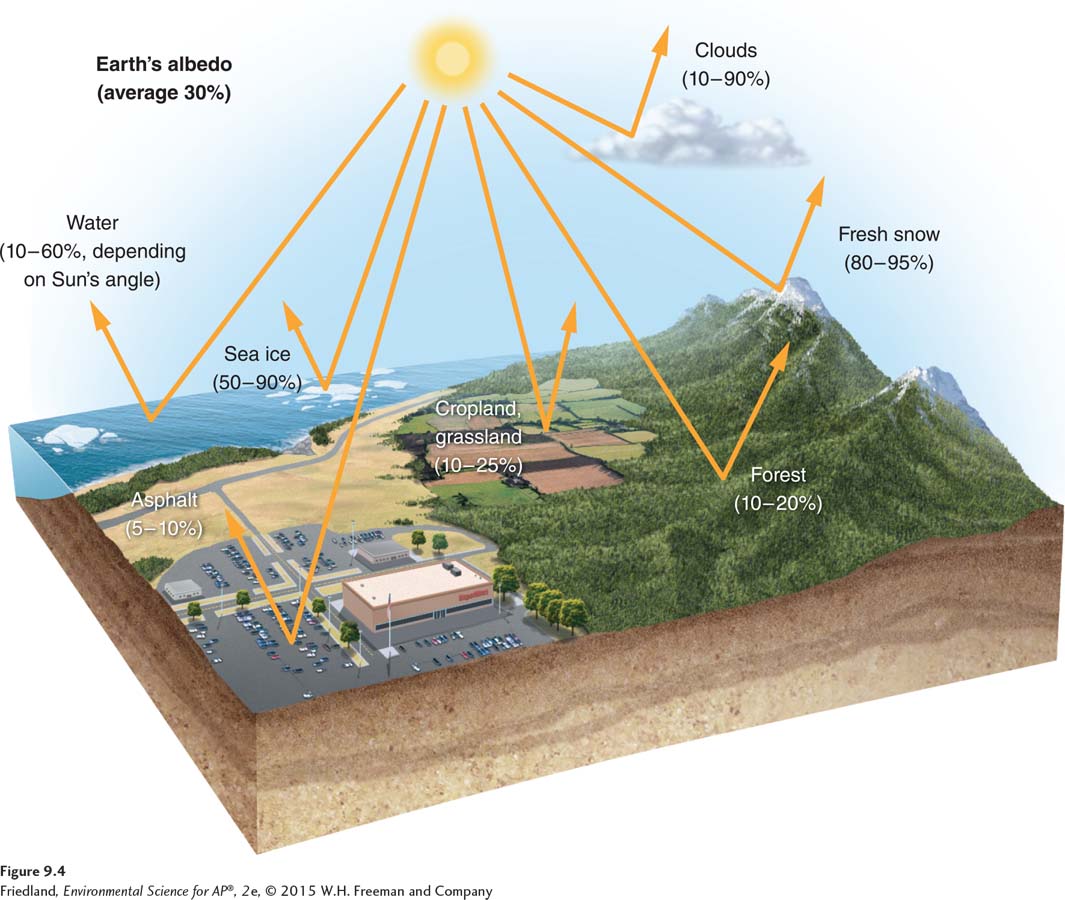
Albedo The percentage of incoming sunlight reflected from a surface.
Finally, some areas of Earth reflect more solar energy than others. The percentage of incoming sunlight that is reflected from a surface is called its albedo. The higher the albedo of a surface, the more solar energy it reflects and the less it absorbs. A white surface has a higher albedo than a black surface, so it tends to stay cooler. FIGURE 9.4 shows albedo values for various surfaces on Earth. Although Earth has an average albedo of 30 percent, tropical regions with dense green foliage have albedo values of 10 to 20 percent, whereas the snow-
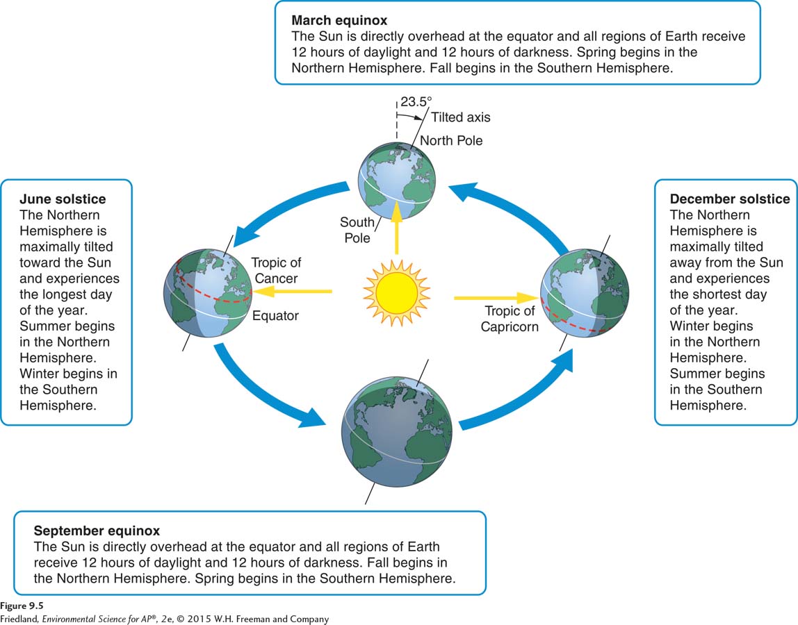
Earth’s tilt causes seasonal changes in climate
As we saw in the previous section, differences in the amount of solar energy striking various latitudes on Earth depend on the angle of the Sun’s rays. For the same reason, the amount of solar energy reaching various latitudes shifts over the course of the year. Because Earth’s axis of rotation is tilted 23.5°, Earth’s orbit around the Sun causes most regions of the world to experience seasonal changes in temperature and precipitation. Specifically, when the Northern Hemisphere is tilted toward the Sun, the Southern Hemisphere is tilted away from the Sun, and vice versa.
FIGURE 9.5 will help us visualize how this works. The Sun’s rays strike the equator directly twice a year: once during the March equinox, on March 20 or 21, and again during the September equinox, on September 22 or 23. On those days, virtually all regions of Earth (except those nearest the poles) receive 12 hours of daylight and 12 hours of darkness. For the 6 months between the March and September equinoxes, the Northern Hemisphere tilts toward the Sun, experiencing more hours of daylight than darkness. The opposite is true in the Southern Hemisphere. On June 20 or 21, the Sun is directly above the Tropic of Cancer at 23.5° N latitude. On this day—