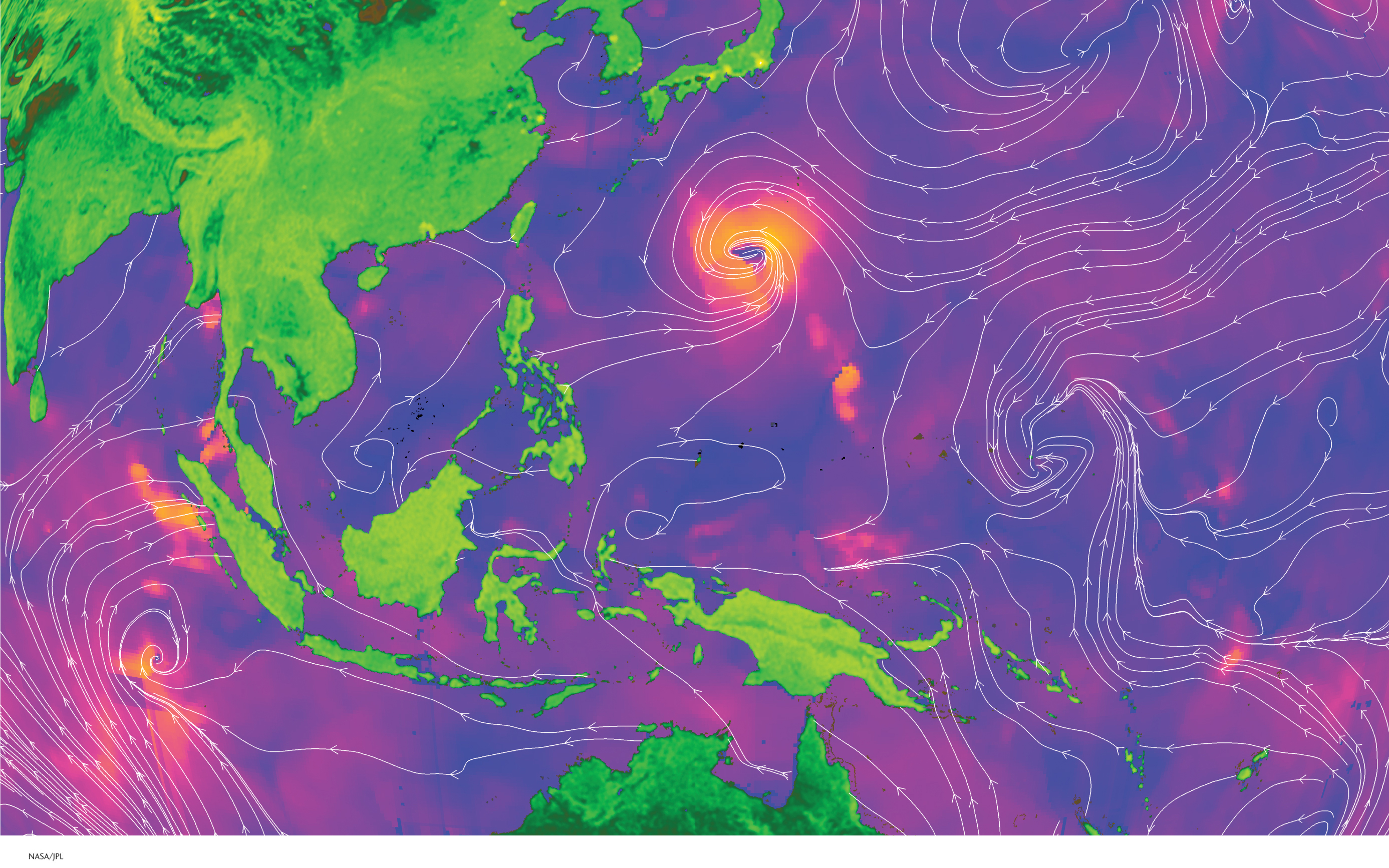
This image of the tropical Pacific Ocean was made using radar sensors on NASA’s QuikSCAT satellite on September 2, 2010. The white arrowed lines, called streamlines, show wind direction. The colored shading represents wind speed. Orange areas, such as those south of Japan, are areas with high-
(NASA/JPL)