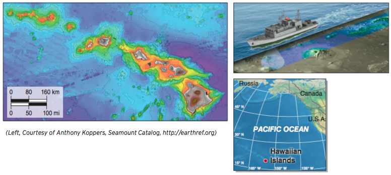
Figure GT.28
Sonar mapping. The world’s ocean basins have been mapped with sonar, revealing the world’s longest mountain ranges and deepest valleys hidden beneath the sea. Transmitters aboard ships send and receive sonar pulses to create an image (inset). This image shows details of the underwater topography of the Hawaiian Islands. Purple and blue areas are over 5,000 m (16,400 ft) deep. Contour lines are also shown for elevation both above and below sea level.(Left, Courtesy of Anthony Koppers, Seamount Catalog, http://earthref.org)