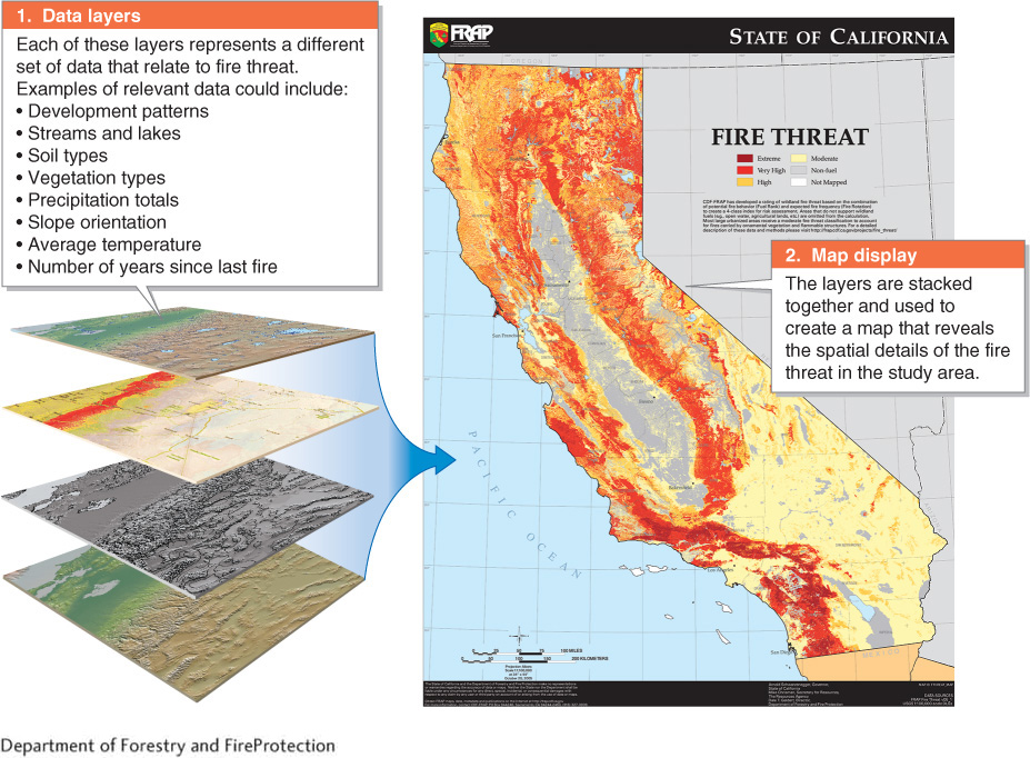
Figure GT.30
Fire map from GIS. This fire threat map of California is useful for fire management and prevention. Areas shown in orange and red are at high risk of fire.(Department of Forestry and FireProtection)
Figure GT.30
Fire map from GIS. This fire threat map of California is useful for fire management and prevention. Areas shown in orange and red are at high risk of fire.