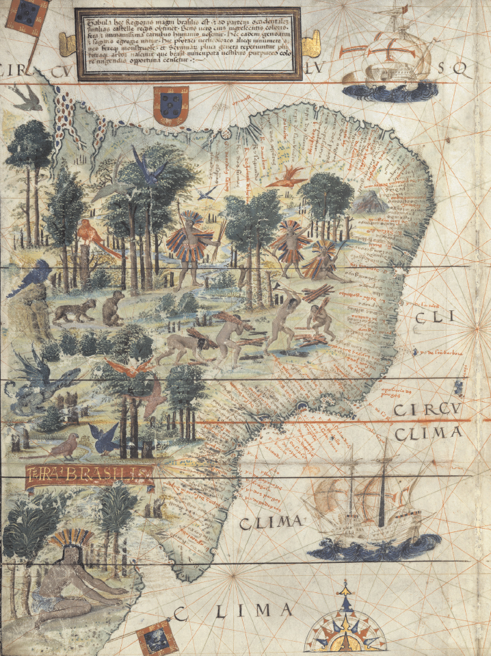
European Map of Brazil, c. 1519
This lavishly illustrated map of Brazil is drawn from the Miller Atlas, made by order of King Manuel I of Portugal around 1519. It features images of Indians harvesting brazilwood; macaws and other colorful birds; a monkey; and — improbably — a fire-breathing dragon. Note, too, the dense annotations and place names along the coast — a reminder that Portuguese familiarity with Brazil was confined almost entirely to the seaboard. Bibliotheque Nationale de France.