The Map Behind Columbus’s Voyage
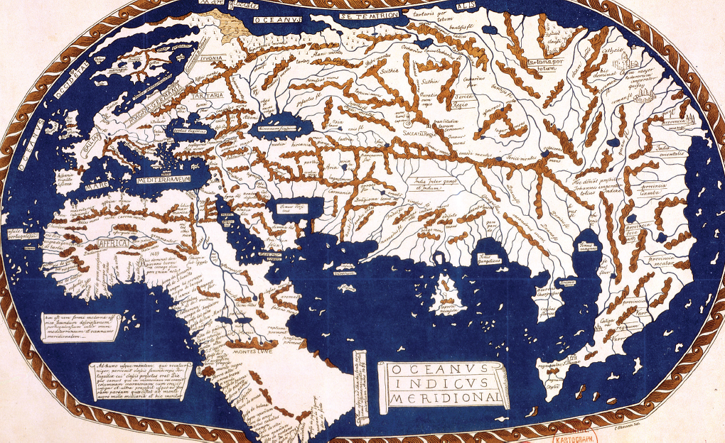
In 1489, Henricus Martellus, a German cartographer living in Florence, produced this huge (4 feet by 6 feet) view of the known world, probably working from a map devised by Christopher Columbus’s brother, Bartholomew. The map uses the spatial projection of the ancient Greek philosopher Claudius Ptolemy (A.D. 90–168) and incorporates information from Marco Polo’s explorations in Asia and Bartolomeu Dias’s recent voyage around the tip of Africa. Most important, it greatly exaggerates the width of Eurasia, thereby suggesting that Asia lies only 5,000 miles west of Europe (rather than the actual distance of 15,000 miles). Using Martellus’s MAP, Columbus persuaded the Spanish monarchs to support his westward voyage. Bildarchiv Preussischer Kulturbesitz/Art Resource, NY.