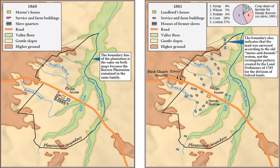
MAP 15.2 The Barrow Plantation, 1860 and 1881
This map is a modern redrawing of one that first appeared in the popular magazine Scribner’s Monthly in April 1881, accompanying an article about the Barrow plantation. Comparing the 1860 map of this central Georgia plantation with the 1881 map reveals the impact of sharecropping on patterns of black residence. In 1860, the slave quarters were clustered near the planter’s house. In contrast, by 1881 the sharecroppers were scattered across the plantation’s 2,000 acres, having built cabins on the ridges between the low-lying streams. The surname Barrow was common among the sharecropping families, which means almost certainly that they had been slaves who, years after emancipation, still had not moved on. For sharecroppers, freedom meant not only their individual lots and cabins but also the school and church shown on the map.