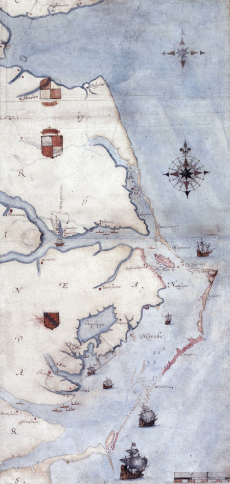
John White’s Map of Virginia
This map, drawn by Roanoke colonist John White, may hold a clue to the fate of the so-called lost colony. The island of Roanoke is right of center, just off the mainland and within the barrier islands. Directly west, on the point where the Roanoke and Chowan rivers join, is a (barely visible) paper patch. When lit from behind, a red fort is clearly visible beneath the patch, suggesting that the Roanoke colonists may already have identified a settlement site there: when he left the colony, John White wrote that the remaining colonists “were prepared to remove from Roanoak 50 miles into the maine[land].” Archaeologists and historians plan to use this discovery to guide further explorations in the area. The Art Archive at Art Resource, NY.