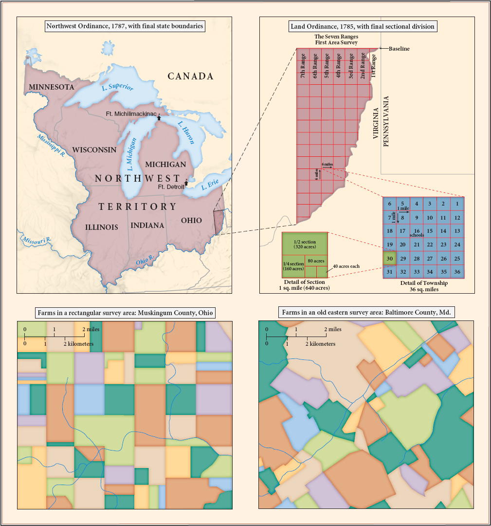
MAP 6.6 Land Division in the Northwest Territory
Throughout the Northwest Territory, government surveyors imposed a rectangular grid on the landscape, regardless of the local topography, so that farmers bought neatly defined tracts of land. The right-angled property lines in Muskingum County, Ohio (lower left), contrasted sharply with those in Baltimore County, Maryland (lower right), where — as in most of the eastern and southern states — boundaries followed the contours of the land.