Mapping the West: Greece, Europe, and the Mediterranean, 400 B.C.E.
Printed Page 109
Important EventsMapping the West: Greece, Europe, and the Mediterranean, 400 B.C.E.
MAPPING THE WEST Greece, Europe, and the Mediterranean, 400 B.C.E.
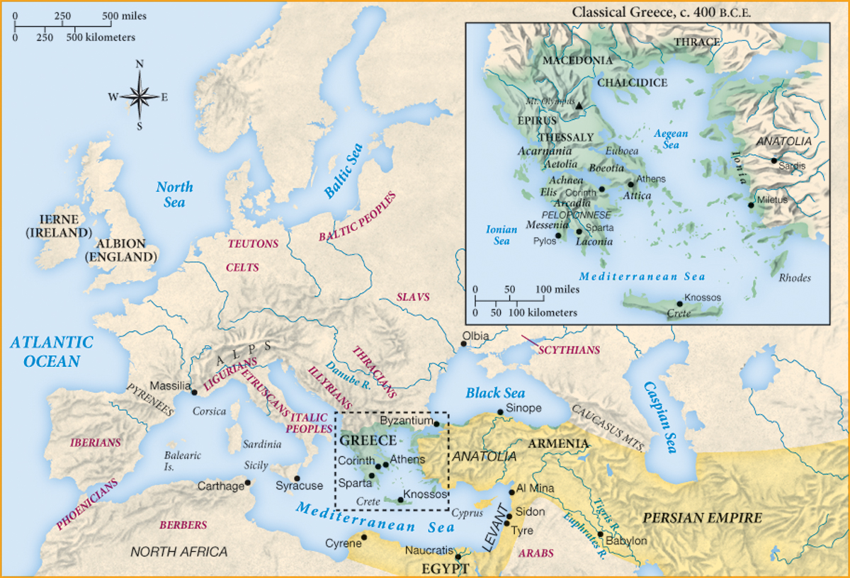
No single power controlled the Mediterranean region at the end of the fifth century B.C.E. In the west, the Phoenician city of Carthage and the Greek cities on Sicily and in southern Italy were rivals for the riches to be won by trade. In the east, the Spartans, confident after their recent victory over Athens in the Peloponnesian War, tried to become an international power outside the mainland for the first time in their history by sending campaigns into Anatolia. This aggressive action aroused stiff opposition from the Persians because it threatened their westernmost imperial provinces. There was to be no peace and quiet in the Mediterranean even after the twenty-seven years of the Peloponnesian War.
Analyzing the Map: The city of Syracuse is located on which large Mediterranean island?
Question
Analyzing the Map: The city of Syracuse is located on which large Mediterranean island?
accept_blank_answers: true
points: 10
Analyzing the Map: The city of Syracuse is located on which large Mediterranean island?
Making Connections: To judge from the territories indicated on the map, why would it have been unexpected for a coalition of Greek city-states to defeat the Persian Empire?
Question
Making Connections: To judge from the territories indicated on the map, why would it have been unexpected for a coalition of Greek city-states to defeat the Persian Empire?
accept_blank_answers: true
points: 10
Making Connections: To judge from the territories indicated on the map, why would it have been unexpected for a coalition of Greek city-states to defeat the Persian Empire?