Mapping the West: Europe and the Mediterranean, c. 1050
Printed Page 310
Important EventsMapping the West: Europe and the Mediterranean, c. 1050
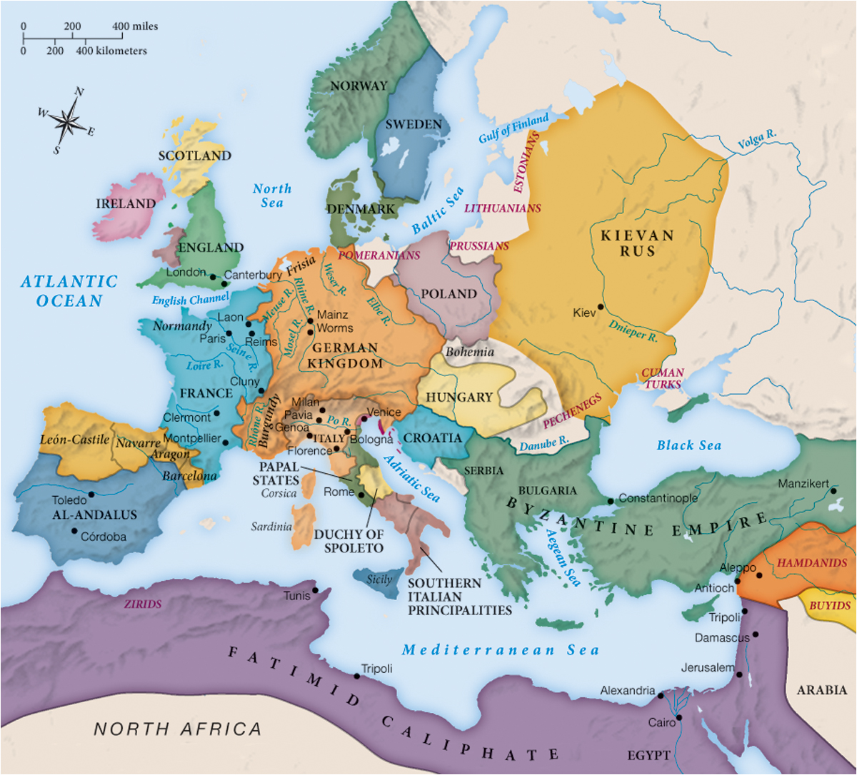
MAPPING THE WEST Europe and the Mediterranean, c. 1050
The clear borders and distinct colors of the “states” on this map distort an essential truth: none of the areas shown had centralized governments that controlled whole territories, as in modern states. Instead, there were numerous regional rulers within each, and there were often competing claims of jurisdiction and conflicting allegiances. Consider Sicily: it was conquered by Muslims in the tenth century, but by 1060 it had been taken over by the Normans—adventurers from Normandy (in France). Its predominantly Greek-speaking population, however, was Greek Orthodox in religion, a legacy of its Byzantine past.
Analyzing the Map: What does this map tell you about the way Spain was ruled c. 1050?
Question
Analyzing the Map: What does this map tell you about the way Spain was ruled c. 1050?
accept_blank_answers: true
points: 10
Analyzing the Map: What does this map tell you about the way Spain was ruled c. 1050?
Making Connections: Together the German Kingdom and the north of Italy on this map formed an empire under what dynasty of rulers?
Question
Making Connections: Together the German Kingdom and the north of Italy on this map formed an empire under what dynasty of rulers?
accept_blank_answers: true
points: 10
Making Connections: Together the German Kingdom and the north of Italy on this map formed an empire under what dynasty of rulers?