Mapping the West: Europe and Byzantium, c. 1215
Printed Page 376
Important EventsMapping the West: Europe and Byzantium, c. 1215
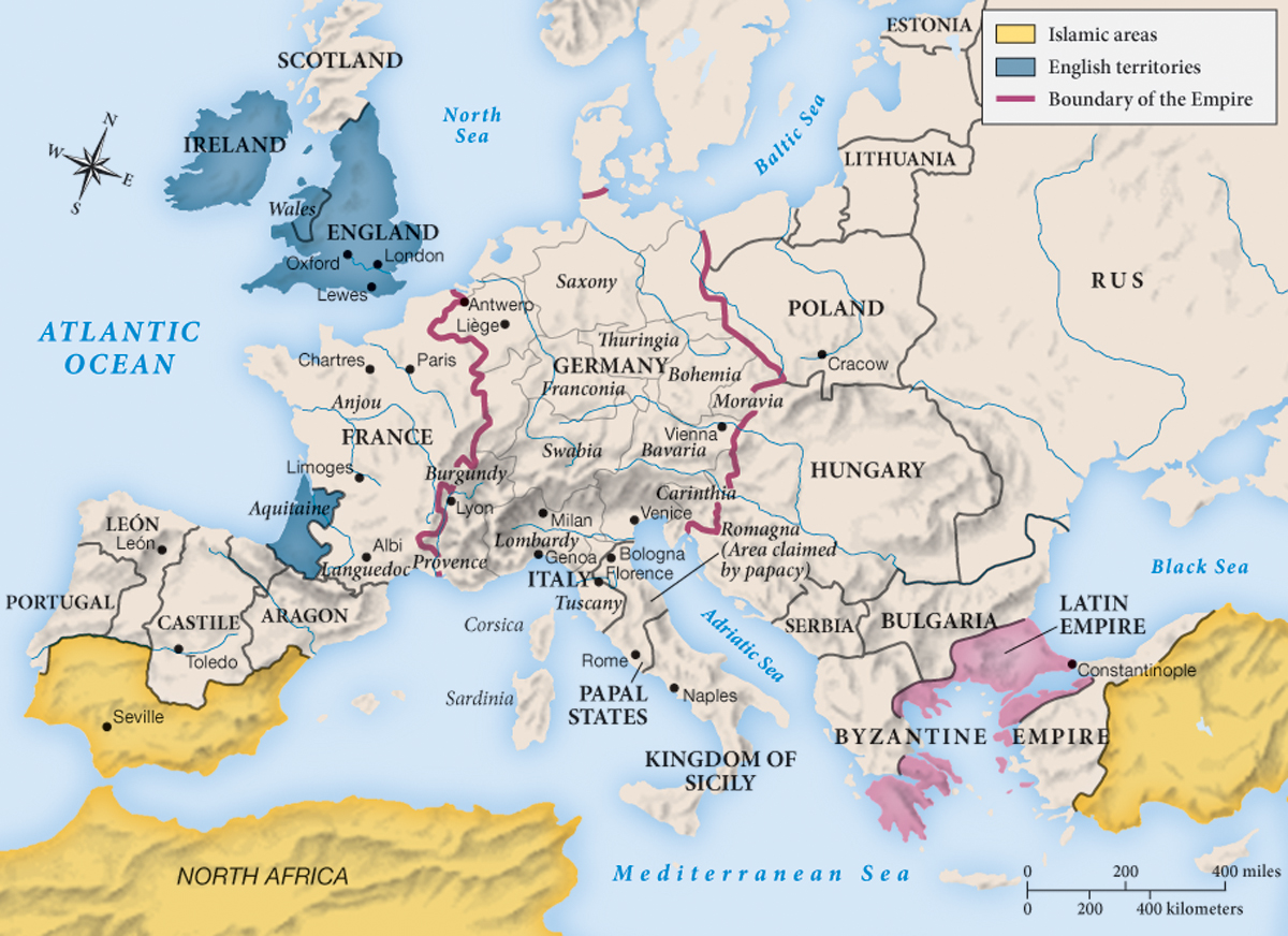
MAPPING THE WEST Europe and Byzantium, c. 1215
The major transformation in the map of the West between 1150 and 1215 was the conquest of Constantinople and the setting up of European rule there until 1261. The Byzantine Empire was now split into two parts. Bulgaria once again gained its independence. If Venice had hoped to control the Adriatic by conquering Constantinople, it must have been disappointed, for Hungary became its rival over the ports of the Dalmatian coast.
Analyzing the Map: What does the pink area on this map represent?
Question
Analyzing the Map: What does the pink area on this map represent?
accept_blank_answers: true
points: 10
Analyzing the Map: What does the pink area on this map represent?
Making Connections: How did English territories come to include Aquitaine but not to include Normandy?
Question
Making Connections: How did English territories come to include Aquitaine but not to include Normandy?
accept_blank_answers: true
points: 10
Making Connections: How did English territories come to include Aquitaine but not to include Normandy?