Mapping the West: Europe in 1750
Printed Page 572
Important EventsMapping the West: Europe in 1750
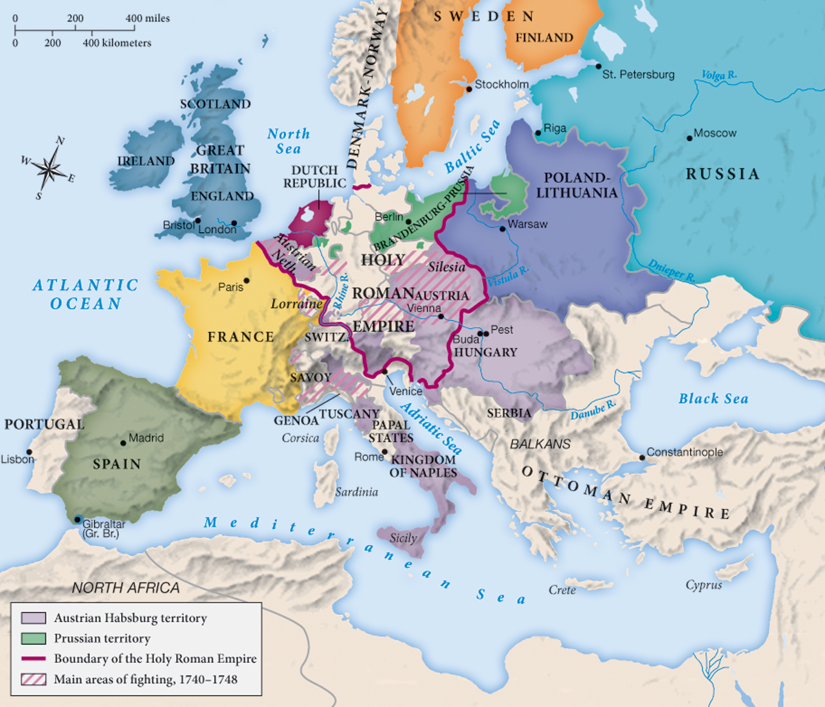
Analyzing the Map: Consider the relative sizes of Poland-Lithuania and France. What geographic factors help explain why the smaller country—France—was more powerful?
Question
Analyzing the Map: Consider the relative sizes of Poland-Lithuania and France. What geographic factors help explain why the smaller country—France—was more powerful?
accept_blank_answers: true
points: 10
Making Connections: Great Britain, Russia, and Prussia were all gaining power in this period. What are the different lessons that can be learned from their rising status?
Question
Making Connections: Great Britain, Russia, and Prussia were all gaining power in this period. What are the different lessons that can be learned from their rising status?
accept_blank_answers: true
points: 10