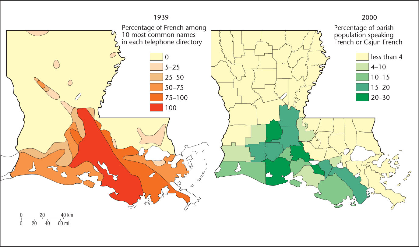
Figure 5.7: Acadiana, the Louisiana French homeland, as mapped by two different methods. The 1939 map was compiled by sampling the surnames in telephone directories. The 10 most common names in each directory were determined, and the percentage of these 10 that were of French origin was recorded. When no telephone directories were available, surnames on mailboxes were used. The 2000 map is based on census data for the percentage of those residing in the parish who spoke French or Cajun French.
(Sources: After Meigs, 1941: 245; U.S. Bureau of the Census, 2000.)