Document 16-1: World Map (1502)
The World as Europeans Knew It in 1502
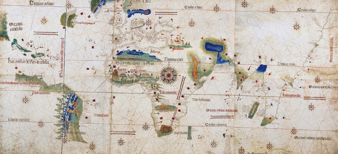
Created in 1502, this map shows the world as Europeans knew it ten years after the voyages of Christopher Columbus. The African coastline is rendered in extraordinarily accurate detail. Trading destinations in India and Southeast Asia are also clearly indicated. The Americas, however, remain a rough sketch, a largely imagined place, not a known one. Nonetheless, the map offers a glimpse of the future. In 1494, Spain and Portugal signed the Treaty of Tordesillas, which established a line of demarcation running north-
READING AND DISCUSSION QUESTIONS
- How would you explain the prominence of Africa on the map? How did Europeans develop such an accurate sense of its coastline?
- What were the larger implications of the Treaty of Tordesillas? What does it tell you about the importance the Spanish and Portuguese attached to the discoveries and achievements of the fifteenth century?