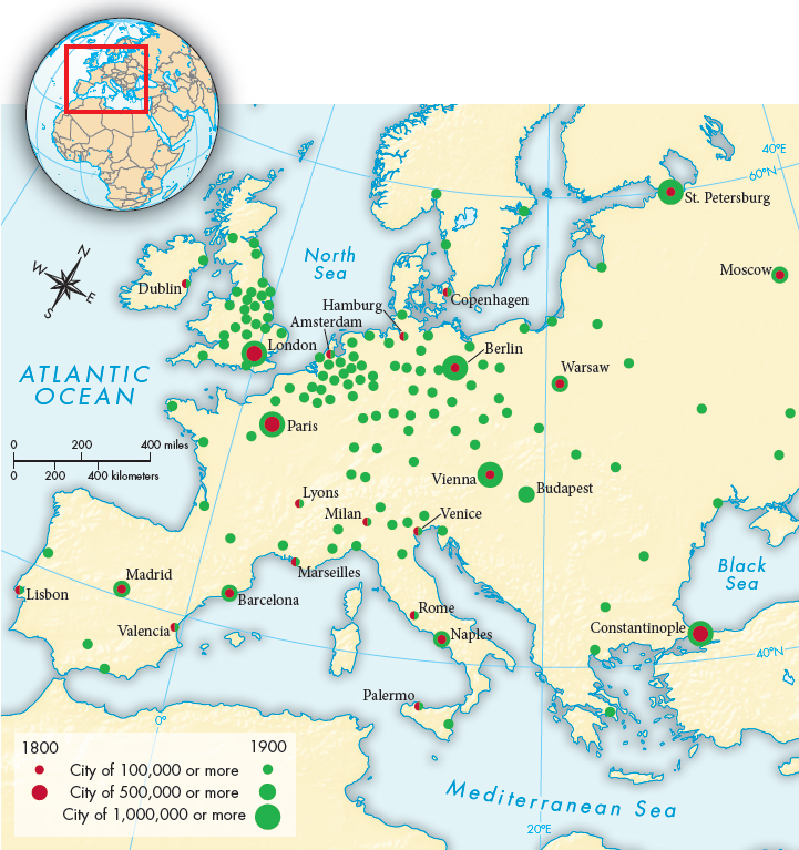
MAP 22.1 European Cities of 100,000 or More, 1800– 1900
There were more large cities in Great Britain in 1900 than in all of Europe in 1800.> MAPPING THE PASTANALYZING THE MAP: Compare the spatial distribution of cities in 1800 with the distribution in 1900. Where in 1900 are large cities concentrated in clusters?
CONNECTIONS: In 1800, what common characteristics were shared by many large European cities? (For example, how many big cities were capitals or leading ports?) Were any common characteristics shared by the large cities in 1900? What does this suggest about the reasons behind this dramatic growth?