Printed Page 532-0(cont.)
A History of Western Society: Printed Page 532
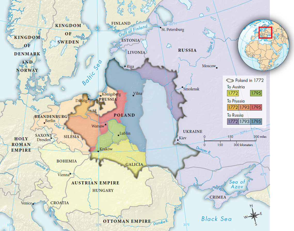
MAPPING THE PAST
Map 16.1 The Partition of Poland, 1772–1795
In 1772 war between Russia and Austria threatened over Russian gains from the Ottoman Empire. To satisfy desires for expansion without fighting, Prussia’s Frederick the Great proposed that parts of Poland be divided among Austria, Prussia, and Russia. In 1793 and 1795 the three powers partitioned the remainder, and the republic of Poland ceased to exist.
Question
ANALYZING THE MAP Of the three powers that divided the kingdom of Poland, which gained the most territory? How did the partition affect the geographical boundaries of each state, and what was the significance? What border with the former Poland remained unchanged? Why do you think this was the case?
Question
CONNECTIONS What does it say about European politics at the time that a country could simply cease to exist on the map? Could that happen today?