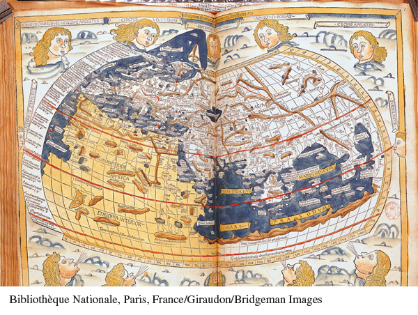
Ptolemy’s Geography The recovery of Ptolemy’s Geography in the early fifteenth century gave Europeans new access to ancient geographical knowledge. This 1486 world map, based on Ptolemy, is a great advance over medieval maps but contains errors with significant consequences for future exploration. It shows a single continent watered by a single ocean, with land covering three-
(Bibliothèque Nationale, Paris, France/Giraudon/Bridgeman Images)