A History of World Societies:
Printed Page 117
A History of World Societies Value
Edition: Printed Page 114
Chapter Chronology
Hellas, as the Greeks call their land, encompasses the Greek peninsula with its southern peninsular extension, known as the Peloponnesus (peh-luh-puh-NEE-suhs), and the islands surrounding it, an area known as the Aegean (ah-JEE-uhn) basin (Map 5.1). In ancient times this basin included the Greek settlements in Ionia, the western coast of the area known as Anatolia in modern western Turkey. During the Bronze Age, which for Greek history is called the “Helladic period,” early settlers in Greece began establishing small communities contoured by the mountains and small plains that shaped the land. The geographical fragmentation of Greece encouraged political fragmentation. Early in Greek history several kingdoms did emerge — the Minoan on the island of Crete and the Mycenaean on the mainland — but the rugged terrain prohibited the growth of a great empire like those of Mesopotamia and Egypt. The Minoan and Mycenaean societies flourished for centuries until the Bronze Age Collapse, when Greece entered a period of decline known as the Dark Age (ca. 1100–800 B.C.E.).
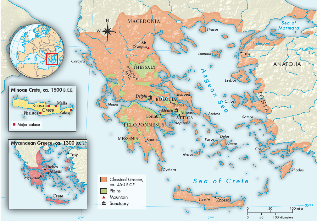
MAP 5.1 Classical Greece, ca. 450 B.C.E. In antiquity the home of the Greeks included the islands of the Aegean and the western shore of Turkey as well as the Greek peninsula itself. Crete, the home of Minoan civilization, is the large island at the bottom of the map. The Peloponnesian peninsula, where Sparta is located, is connected to the rest of mainland Greece by a very narrow isthmus at Corinth.