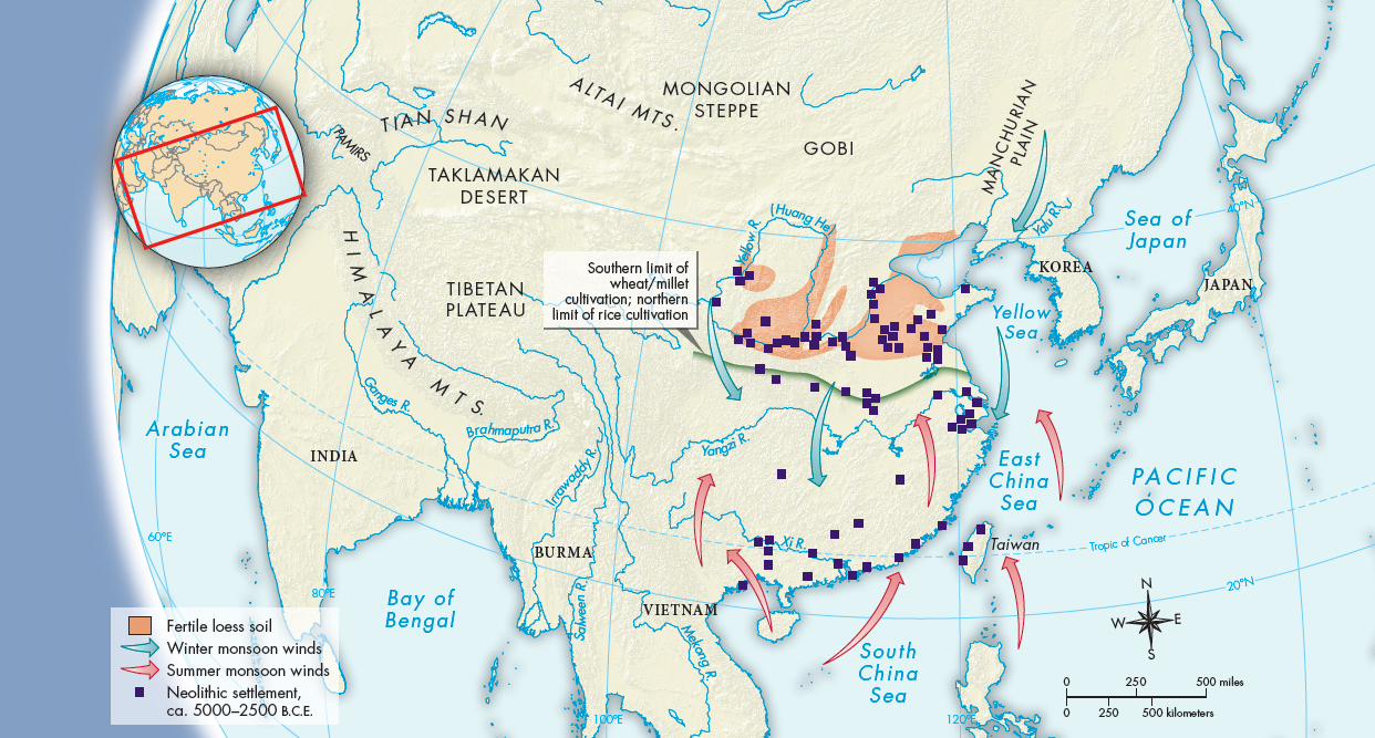
MAP 4.1The Geography of Historical ChinaChinese civilization developed in the temperate regions drained by the Yellow and Yangzi Rivers.> MAPPING THE PAST
ANALYZING THE MAP: Trace the routes of the Yellow and Yangzi Rivers. Where are the areas of loess soil? Where are the Neolithic sites concentrated?CONNECTIONS: Does China’s geography explain much about its history? (See also Map 4.2.) What geographical features had the greatest impact in the Neolithic Age? How might the fact that the Yellow and Yangzi Rivers flow west to east, rather than north to south, have influenced the development of Chinese society?
ANALYZING THE MAP: Trace the routes of the Yellow and Yangzi Rivers. Where are the areas of loess soil? Where are the Neolithic sites concentrated?CONNECTIONS: Does China’s geography explain much about its history? (See also Map 4.2.) What geographical features had the greatest impact in the Neolithic Age? How might the fact that the Yellow and Yangzi Rivers flow west to east, rather than north to south, have influenced the development of Chinese society?