Understanding World Societies:
Printed Page 462
Technology and the Rise of Exploration
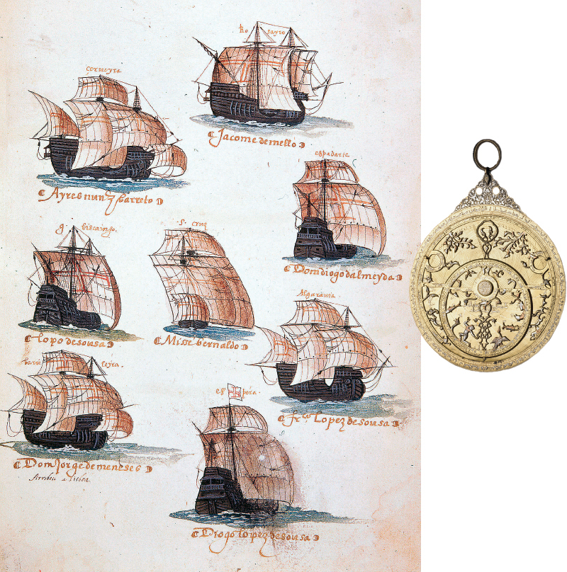
This image shows a Portuguese trading fleet in the late fifteenth century bound for the riches of the Indies. Between 1500 and 1635 over nine hundred ships sailed from Portugal to ports on the Indian Ocean in annual fleets composed of five to ten ships. Portuguese sailors used astrolabes, such as the one pictured here, to accurately plot their position. (fleet: British Museum/HarperCollins Publishers/The Art Archive at Art Resource, NY; astrolabe: © The Trustees of the British Museum/Art Resource, NY)
Technological developments in shipbuilding, navigation, and weaponry enabled European expansion. Since ancient times, most seagoing vessels had been narrow, open boats called galleys, propelled by slaves or convicts manning the oars. The need for sturdier craft, as well as population losses caused by the Black Death, forced the development of a new style of ship that would not require much manpower. Over the course of the fifteenth century the Portuguese developed the caravel, a small, light, three-
This period also saw great strides in cartography and navigational aids. Around 1410 Arab scholars reintroduced Europeans to Ptolemy’s Geography. Written in the second century, the work synthesized the geographical knowledge of the classical world. It represented a major improvement over medieval cartography, but it also contained significant errors. Unaware of the Americas, Ptolemy showed the world as much smaller than it is, so that Asia appeared not very far to the west of Europe.
The magnetic compass made it possible for sailors to determine their direction and position at sea. The astrolabe, an instrument invented by the ancient Greeks and perfected by Muslim navigators, was used to determine the altitude of the sun and other celestial bodies. It permitted mariners to plot their latitude, that is, their precise position north or south of the equator.
Like the astrolabe, much of the new technology that Europeans used on their voyages was borrowed from the East. Gunpowder, the compass, and the sternpost rudder were Chinese inventions. Advances in cartography also drew on the rich tradition of Judeo-