Global circulation patterns determine patterns of rainfall, but topography also matters.
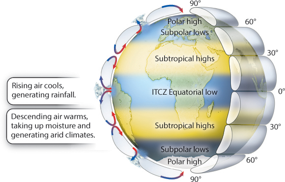
To fully understand the features and distribution of biomes around Earth, we must introduce another physical principle: Warm air can carry more water vapor than can cold air. Armed with this insight, we can return to the global circulation of air. Warm air at the equator carries a great deal of water vapor, but, as it rises and the air cools, the amount of water vapor it can carry decreases. As a result, the vapor condenses, and it rains. Conversely, the air descending at about 23 to 30 degrees latitude north and south warms as it sinks and so takes up water vapor rather than releasing it; aridity results. As shown in Fig. 48.6, zones of high and low annual rainfall follow this broad pattern of rising and descending masses, with the highest rainfall near the equator and the lowest rainfall in belts between 23 and 30 degrees latitude north and south.
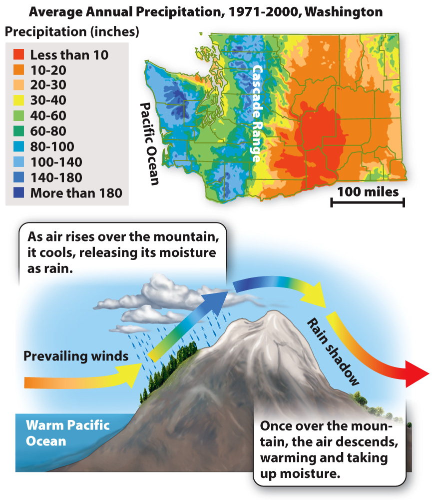
Regional precipitation (rain or snow) patterns are actually more complicated than this simple picture would suggest, as seen in the precipitation map for Washington state (Fig. 48.7). From the coast eastward into the Cascade Mountains, Washington and neighboring British Columbia are wet all year long, supporting magnificent conifer forests. However, east of the Cascades and the Coast Mountains that extend to the north, the land is dry. This observation suggests that the mountains themselves impose a regional pattern of rainfall. The effect is called a rain shadow, and it reflects the same general principles of rising and descending air masses. As wet air moves from the ocean up into the mountains, it cools, releasing its moisture as precipitation. Moving past the mountains, air masses descend, warming as they go and taking up water vapor. For this reason, lands in the rain shadow of the mountains are arid (Fig. 48.7).
In general, then, regional climate reflects the interactions among solar radiation, global patterns of circulation, and Earth’s varying topography. Biomes, in turn, reflect these variations in climate.