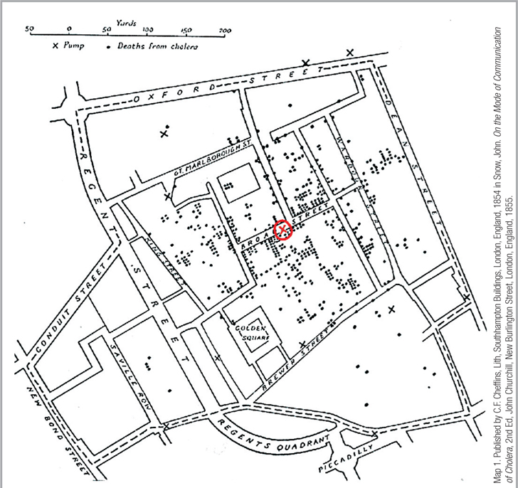
John Snow’s Famous Map Dr. John Snow solved the urgent mystery of how cholera could infect so many people so suddenly by mapping cholera deaths in relation to the Broad Street water well. The X’s are all neighborhood wells. The X in the red circle is the Broad Street well. Each dot indicates that a person living at this address died of cholera, and a cluster of cases is clearly seen around the Broad Street well (but not around the other wells). Snow was careful to include the other X’s to demonstrate that the deaths were closer to one specific source of water.
Map 1. Published by C.F. Cheffins, Lith, Southhampton Buildings, London, England, 1854 in Snow, John. On the Mode of Communication of Cholera, 2nd Ed, John Churchill, New Burlington Street, London, England, 1855.