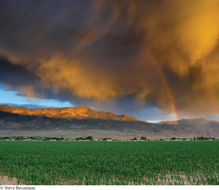
“There was a hot desert wind blowing that night. It was one of those hot dry Santa Anas that come down through the mountain passes and curl your hair and make your nerves jump and your skin itch. On a night like that every booze party ends in a fight. Meek little wives feel the edge of a carving knife and study their husbands’ necks. Anything can happen.”
— RAYMOND CHANDLER, Red Wind, 1938
Temperature and rainfall, that’s all. The type of terrestrial biome depends on little else besides these two aspects of the weather. But what determines the temperature and rainfall in a particular part of the world? Differences in both ultimately result from one simple fact: the earth is round. As we’ll see, the earth’s curvature influences temperature, and rainfall patterns are an inevitable consequence of the variation in temperature across the globe.
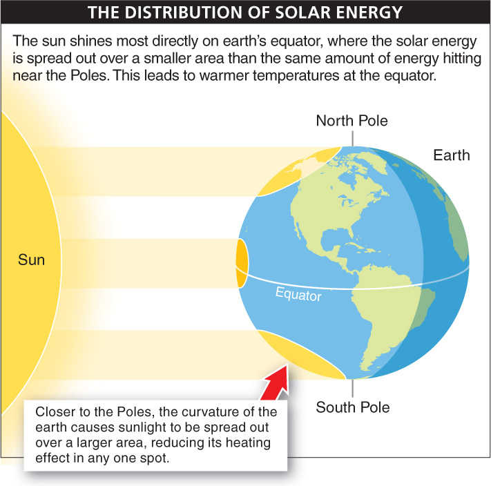
Wherever you are, begin walking toward the equator. As you get closer, it gets hotter. Nearly everyone is aware of this universal trend (and the reverse as well: it gets colder as you move away from the equator and approach the North or South Pole). What is responsible for the increased warmth at the equator?
The sun shines most directly on the equator (FIGURE 15-5). At the equator, solar energy hits the earth and spreads out over a relatively small area. Away from the equator, the earth curves toward the North and South Poles. Because of this curvature, the same amount of solar energy hitting the earth at the Poles is spread out over a much larger area and also travels a greater distance through the atmosphere, which absorbs or reflects much of the heat. With the energy dispersed over a large area, there is less warmth at any one point on the earth’s surface. It’s similar to the fact that at noon, the sun’s rays hit the earth at a more direct angle than they do later in the day. That is why the sun provides less warmth late or early in the day. It is also why the risk of sunburn and skin cancer is greatest around noon and the nearer you are to the equator.
615
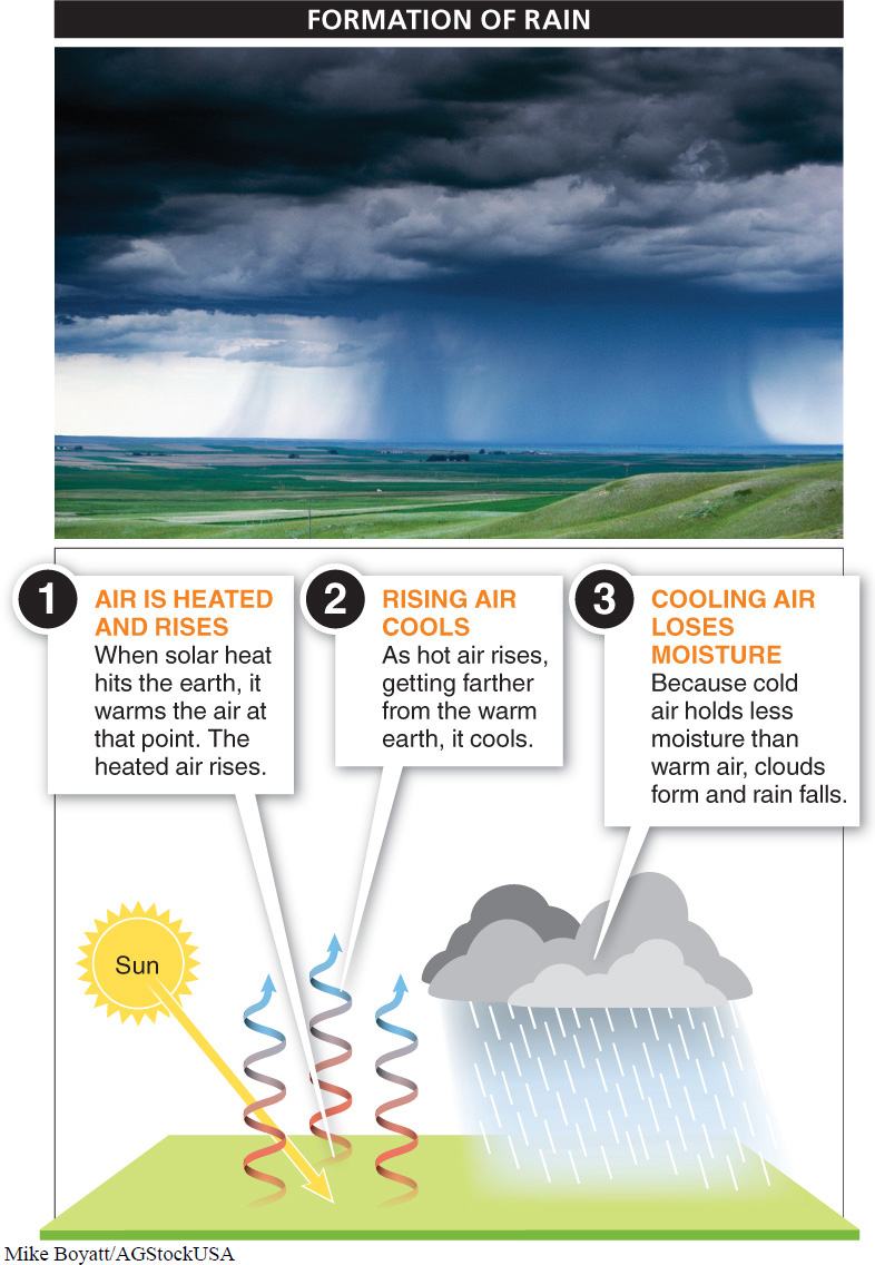
Global patterns of rainfall can be predicted just as easily, by taking into account that warm air holds more moisture than cold air. We’ll start at the equator again, where the greatest warming power of the sun hits the earth, and some of that energy radiates back, warming the air. This starts a three-
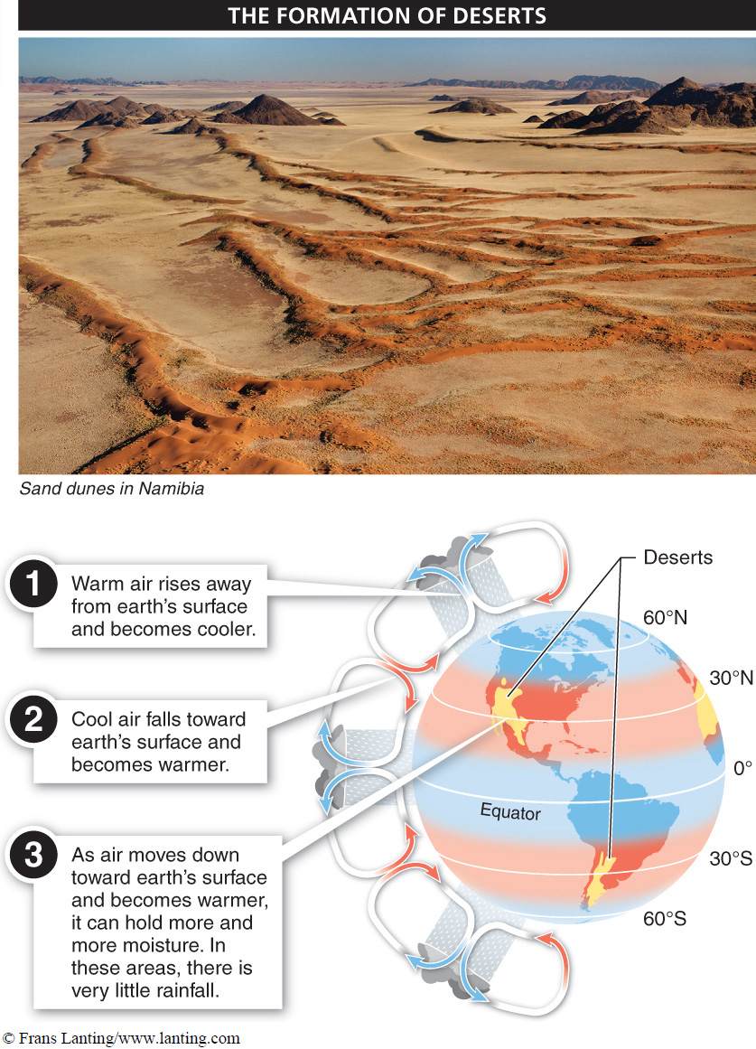
Nearly all of the world’s deserts occur a third of the way from the equator toward the Poles, at 30° latitude. Is this just a coincidence?
The high, cold air in the atmosphere over the equator expands outward, to about 30° north and south. Here, the cold air, which is heavier than warm air, begins to fall downward toward the earth and is warmed by heat radiated off the earth’s surface. As the air gets warmer, it can hold more and more moisture, rather than releasing it as rain. In fact, the falling and rapidly heating air can hold so much moisture that it sometimes sucks up moisture from the land itself. For this reason, at about 30° north and south, around the world, there is very little rainfall, the ground is very dry, and deserts form (FIGURE 15-7). The Atacama Desert of South America, which lies at approximately 30° south of the equator, is an extreme example. In some parts of this large desert, no rainfall has ever been recorded. Other great deserts of the world are also at 30° latitude, including the Sahara, Kalahari, Mojave, and Australian deserts (although some deserts do occur at other latitudes). These areas stand in stark contrast to the equator, where it is not uncommon for an area to receive more than 3 meters (almost 120 inches) of rain in a year.
616
As the air falls near 30° north and south and hits the earth, it spreads equally toward the equator and toward the Poles, gradually getting warmer, until, at around 60° latitude, it begins to rise because of its accumulated heat. Again, the rising air loses its moisture as rainfall. So at 60° latitude, two-
TAKE-HOME MESSAGE 15.3
Global patterns of weather are largely determined by the earth’s round shape. Solar energy hits the equator at a more direct angle than at the Poles, leading to warmer temperatures at lower latitudes. This temperature gradient generates atmospheric circulation patterns that result in heavy rain at the equator and many deserts at 30° latitude.
Global weather patterns are mainly determined by the amount of solar energy falling on an area. The amount of solar energy that falls on an area largely depends on the angle at which this light hits the earth. Explain what this means.
Because the earth is round, solar energy hitting at a Pole is spread out over a wider area compared to an equal amount of solar energy hitting the earth at the equator.