Central India
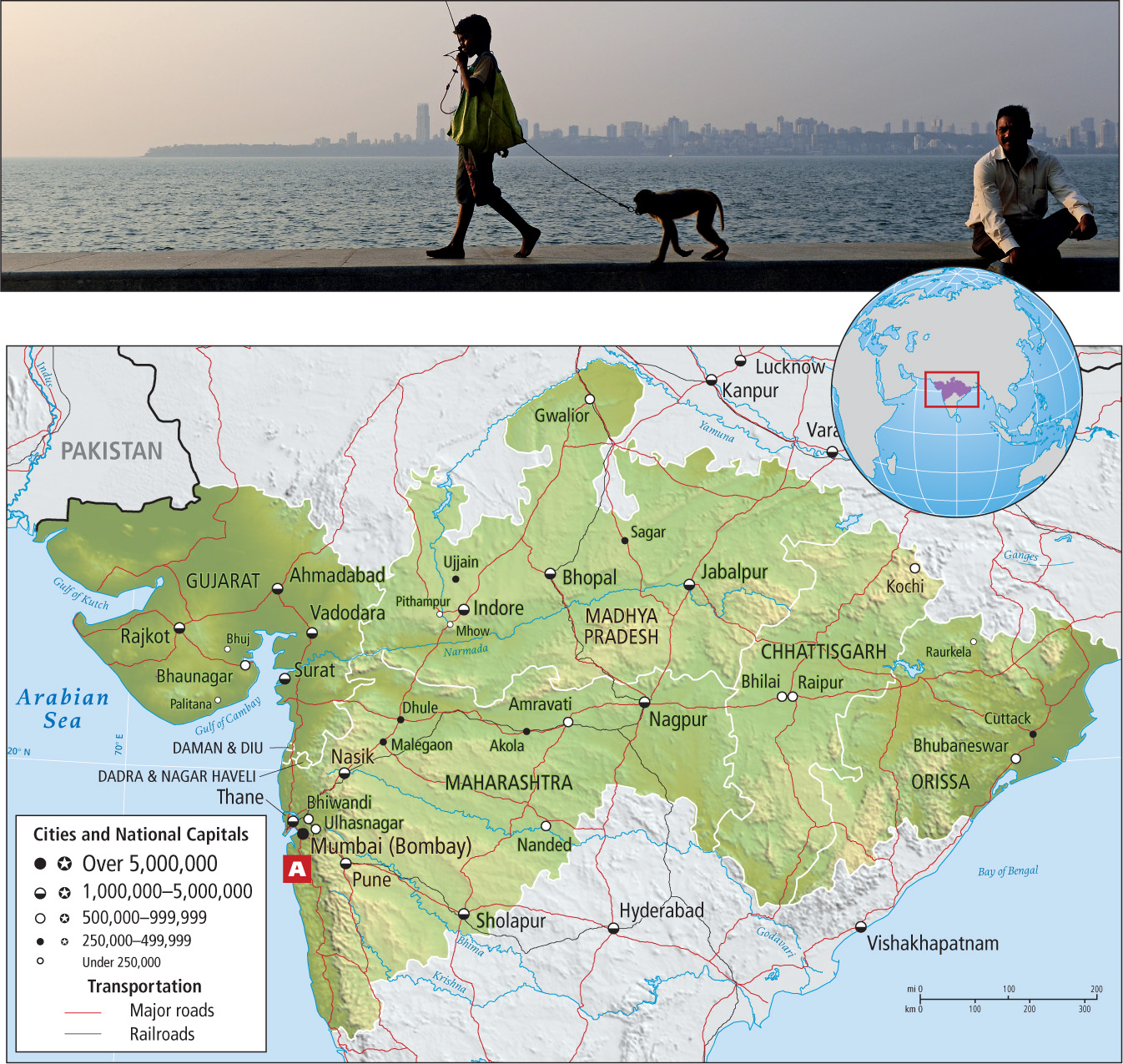
The Central India subregion stretches across the middle of India, from Gujarat in the west to Orissa in the east (Figure 8.39). It contains India’s last untouched natural areas as well as much of its industry. The Narmada River, site of many planned hydroelectric and multipurpose dams, flows across the subregion and empties into the Gulf of Cambay.
Some of India’s most significant environmental battles are being fought in the central highlands of this subregion; the protests over the damming of the Narmada River, described at the beginning of this chapter, are only one example. Central India has most of India’s remaining forest cover and is home to a concentration of national parks and sanctuaries (most notably tiger reserves; see Figure 8.9A). However, because the forest cover is patchy, not continuous, many wild plants and animals are isolated in such small populations that their extinction is highly likely, even if it is somewhat delayed by the parks’ protection. In recognition of this problem, there are now plans to reconstitute forest corridors between parks. Estimates of future human population growth, however, do not bode well for the future of wildlife anywhere in the subregion.
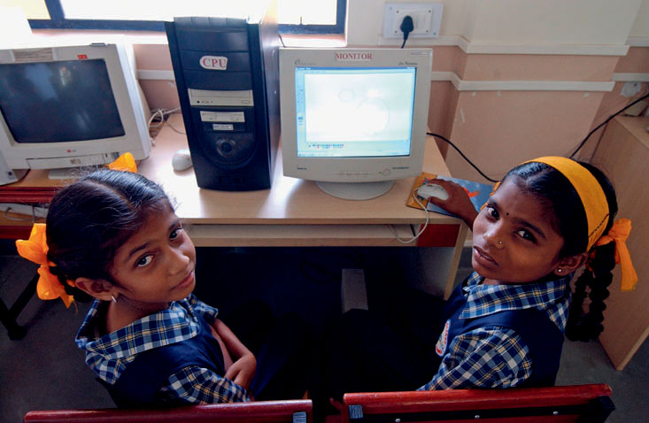
Central India is notable for its several industrial areas, most of which are now rebounding from the global recession. In the state of Gujarat, on the Arabian Sea, the service and industrial sectors account for 75 percent of GDP; the rate is even higher, at 83 percent, in the neighboring state of Maharashtra, where education for females has increased (Figure 8.40). Even the central plateau and eastern areas of Central India, although more rural in character, have pockets of industrial activity that are spreading and connecting. An example is the city of Indore (see the Figure 8.39 map), a commercial and industrial hub whose residents think of it as a mini Mumbai. Nearby, the town of Pithampur, known as India’s Detroit and now home to 1.2 million people, houses several automobile plants, a steel plant, a container plant, and small appliance factories. Production in Pithampur’s automotive industries is climbing back after a slump in 2009, but its continued growth is dependent on the rail connections to Ahmadabad, Mumbai, Indore, and Delhi that use the old British tracks, with their mismatched gauges, being upgraded to the now-standard broad gauge—all of which will require government subsidies. Industrialization, of course, leads to urbanization; in fact, the western part of this subregion is exceptionally urbanized for India. In Gujarat, about 38 percent of the people live in urban areas; in Maharashtra, the home of the mega-city Mumbai (with 22.9 million inhabitants; see Figure 8.39A), about 43 percent do. Mumbai exerts enormous influence on all development in Maharashtra. Its many aspects are covered.
THINGS TO REMEMBER
 The Central India subregion contains India’s last untouched natural areas as well as much of its industry.
- Mumbai, the principal city in Central India and the country’s financial capital and largest city, is joined by other cities that are booming industrial centers.