8.2 The Geographic Setting
What Makes South Asia a Region?
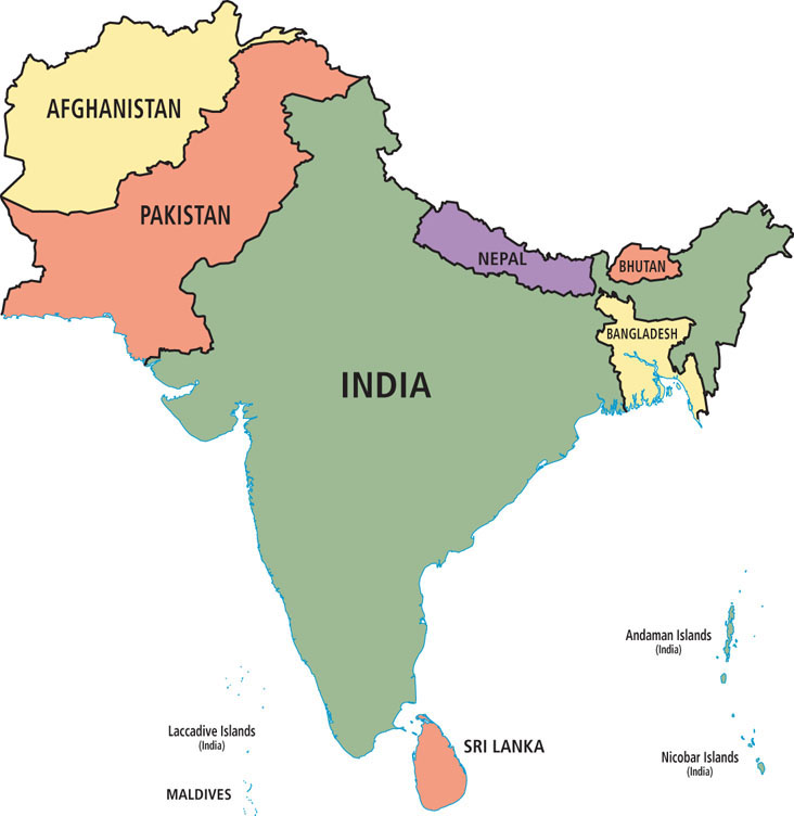
The countries that make up the South Asia region in this book are Afghanistan and Pakistan in the northwest; the Himalayan states of Nepal and Bhutan; Bangladesh in the northeast; India (including the Indian territories of the Lakshadweep, Andaman, and Nicobar Islands); and the island countries of Sri Lanka and the Maldives (Figure 8.3; see also Figure 8.1). Physically, these countries occupy territory known as the Asian subcontinent—the portion of a tectonic plate that joined the Eurasian continent nearly 60 million years ago (discussed below). Historically and culturally, these modern countries have a shared patchwork of religious, social, and political features linked to ancient conquerors from Central Asia, explorers and traders from the Arabian Peninsula and Southeast Asia, and more recent colonizers from Europe. A patchwork is a good image, because the long history of internal and external influences have left this region with a fragmented and overlapping pattern of religions, languages, ethnicities, economic theories, forms of government, attitudes toward gender and class, and ideas about land and resource use.
Terms in This Chapter
subcontinent a term often used to refer to the entire Indian peninsula, including Nepal, Bhutan, India, Pakistan, and Bangladesh
South Asians have recently adopted new place names to replace the names given them during British colonial rule. The city of Bombay, for example, is now officially Mumbai, Madras is Chennai, Calcutta is Kolkata, Benares is Varanasi, and the Ganges River is the Ganga River.