10.1 Chapter 10 SOUTHEAST ASIA
chapter 10
SOUTHEAST ASIA▶
GEOGRAPHIC INSIGHTS: SOUTHEAST ASIA
After you read this chapter, you will be able to discuss the following geographic insights as they relate to the five thematic concepts:
|
1. |
Environment: |
Many of Southeast Asia’s most critical environmental issues relate in some way to climate change. Deforestation is rapid in this region and is a major global source of greenhouse gas emissions, which intensify climate change. This region is also highly vulnerable to the impacts of climate change. Increased flooding and droughts threaten food production on land and rising ocean temperatures strain aquatic ecosystems. |
|
2. |
Globalization and Development: |
Globalization has brought both spectacular successes and occasional declines to the economies of Southeast Asia. Key to the economic development of this region are strategies that were pioneered earlier in East Asia: the formation of state- |
|
3. |
Power and Politics: |
There has been a general expansion of political freedoms throughout Southeast Asia in recent decades, but authoritarianism, corruption, and violence have at times reversed these gains. |
|
4. |
Urbanization: |
While Southeast Asia as a whole is only 43 percent urban, its cities are growing rapidly as agricultural employment declines and urban industries expand. The largest Southeast Asian cities, which are receiving most of the new rural- |
|
5. |
Population and Gender: |
Population dynamics vary considerably in this region because of differences in economic development, government policies, prescribed gender roles, and religious and cultural practices. With regard to gender, economic change has brought better job opportunities and increased status for women, who then often choose to have fewer children. Some countries also have gender imbalances because of a cultural preference for male children. |
The Southeast Asia Region
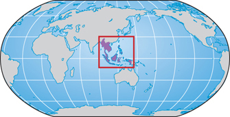
The region of Southeast Asia (shown in Figure 10.1) has attracted global attention for several decades because so many of its countries emerged poverty-
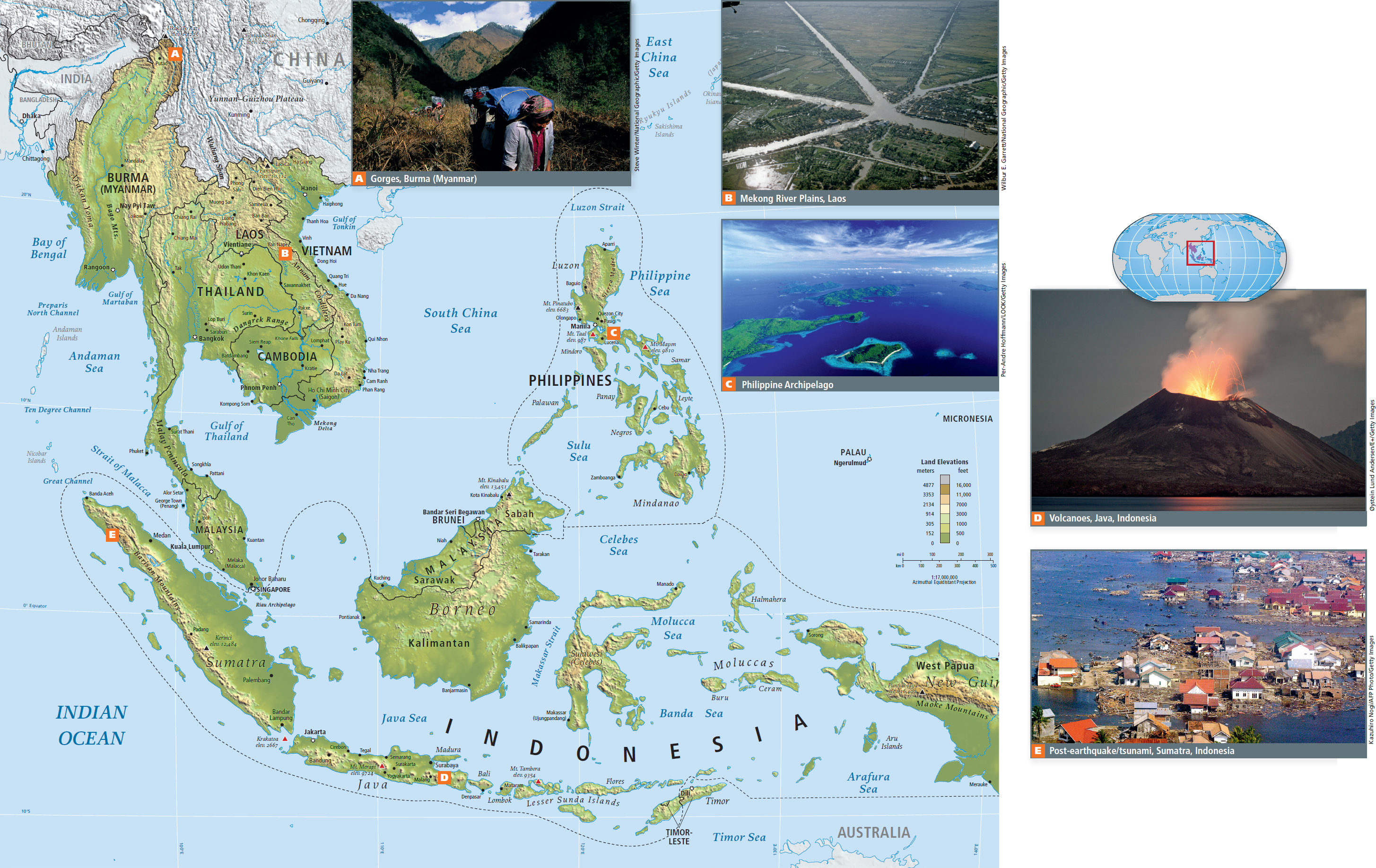
The five thematic concepts in this book are explored as they arise in the discussion of regional issues, with interactions between two or more themes featured. Vignettes, like the one that follows about the rights of a group of people indigenous to the state of Sarawak on the island of Borneo, illustrate one or more of the themes as they are experienced in individual lives.
GLOBAL PATTERNS, LOCAL LIVES
In December 2005, a group of indigenous people in the Malaysian state of Sarawak, on the island of Borneo (see the Figure 10.1 map), attended a public meeting wearing orangutan masks. They carried signs informing onlookers that, although the government protects natural areas for orangutan, it ignores the basic right of indigenous people to live on their own ancestral lands and practice their forest skills (Figure 10.2A).
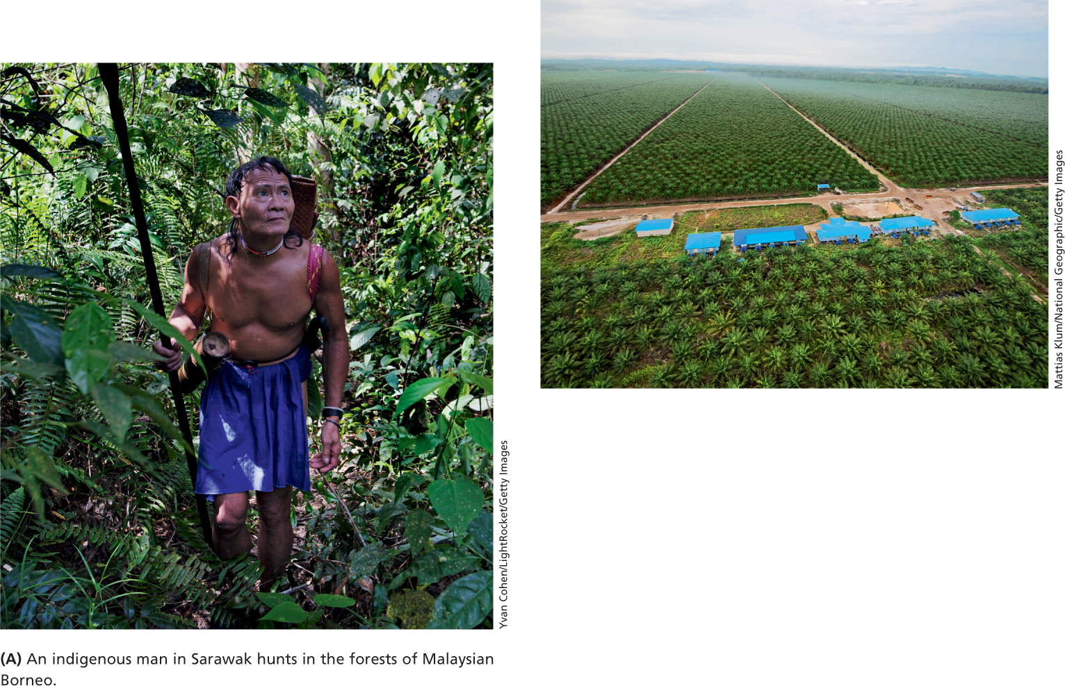
Over the years, Sarawak forest dwellers have tried many tactics to save their lands from the deforestation that logging companies do in preparation for expanding the oil palm plantations (see Figure 10.2B). Palm oil is a major food and cosmetic oil export; it is sold primarily to Europe, North America, Japan, and China. In the mid-
In the 1990s, a group of citizens in Berkeley, California, who were concerned about news reports of the deforestation in Sarawak, organized the Borneo Project. They offered to become a “sister city” to one indigenous group in Sarawak, the Uma Bawang, giving help wherever it was needed. With the help of the Borneo Project, the Uma Bawang began a community-
This favorable court ruling was challenged in 2005 when the government appealed, but in 2009, the Malaysian federal court ruled in favor of the Uma Bawang. The decision stated that native customary land rights had been protected since 1939, when British colonial officials had directed the district lands and survey departments to map the boundaries of native lands. Now indigenous people have the right to sue the government for past illegal leases to logging companies, and as of 2011, some 203 such cases were in litigation. The outcome of this litigation is as yet unclear, and in the Indonesian part of Borneo, deforestation for oil palm plantations is proceeding rapidly, as shown in the 2011 video “Indigenous Community Witnesses End of Forest for Palm Oil,” at http:/
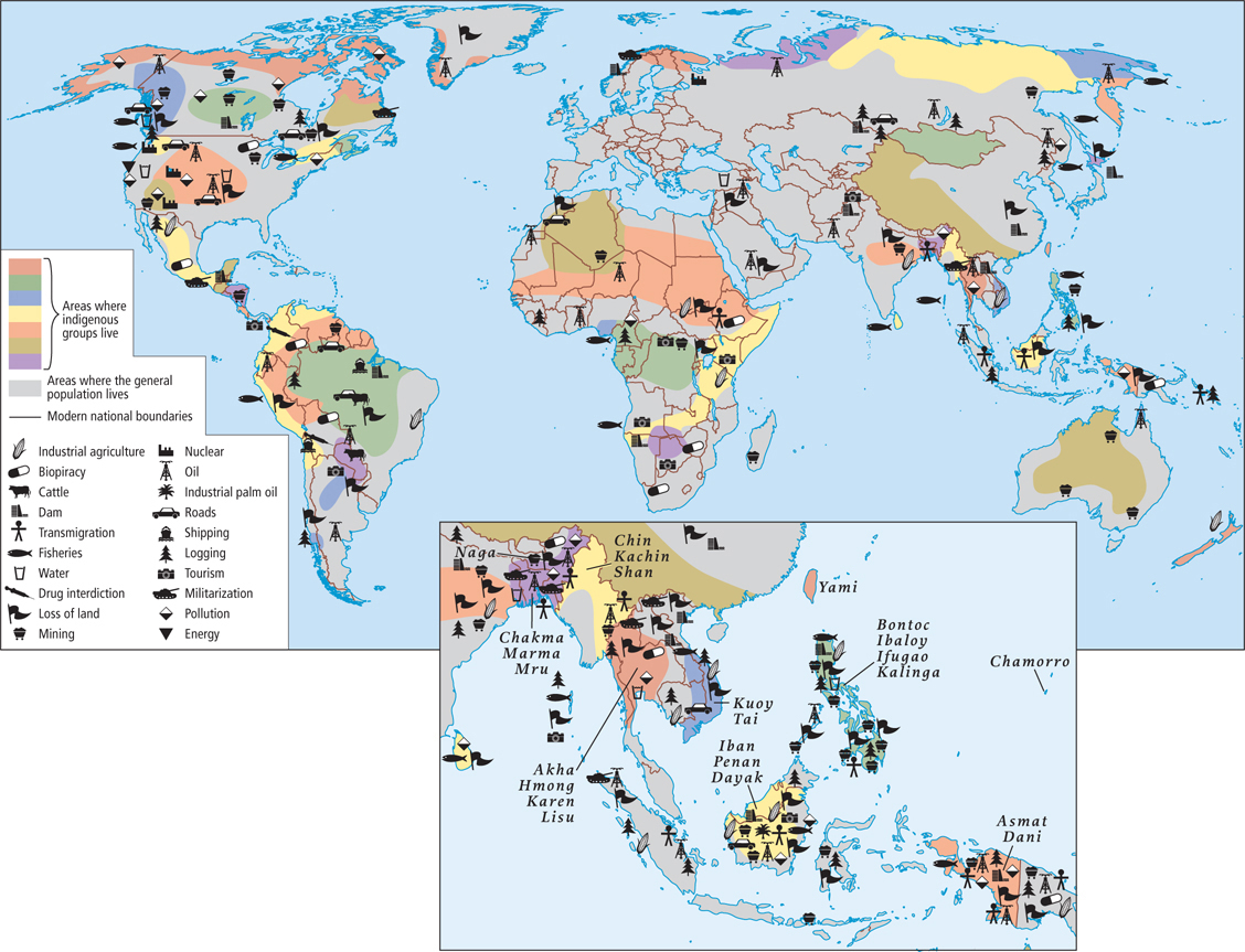
This account of the tactics that indigenous groups are using to secure their rights to control and manage their ancestral lands mirrors the accounts of similar struggles in Middle and South America and highlights a number of themes in this book: the environment, globalization and development, and power and politics. In particular, it shows how issues that may seem to have only local significance can gain global attention. This connection of the local to the global presents both challenges and opportunities for the world’s indigenous people (Figure 10.3). On one hand, the global market provides the demand for timber and palm oil; on the other, it is support from groups like the Borneo Project that help communities such as the Uma Bawang have their land claims validated. In fact, the use of mapping to help indigenous groups secure their legal rights to ancestral lands has now become a global phenomenon. Hundreds of indigenous groups throughout the world are collaborating with mapping specialists, many of them geographers, often resulting in their land rights being formally recognized by governments for the first time. In 2007, the United Nations’ Department of Economic and Social Affairs passed the Declaration on the Rights of Indigenous People and issued a report, State of the World’s Indigenous Peoples, that documents several indigenous community mapping efforts.
What Makes Southeast Asia a Region?
Southeast Asia is physically a manifestation of tectonic forces that are described in the “Physical Patterns” section. Aside from physical commonalities, the peninsula and island countries of Southeast Asia today share a deep cultural past, related to but separate from the cultures of southwestern China. With the exception of Thailand, they all also share more recent experiences with European colonialism. During and after World War II, most countries went through severe political turmoil followed by the rapid modernization and industrialization that continues into the present.
Terms in This Chapter
The mainland Southeast Asian countries are Burma, Thailand, Laos, Cambodia, Vietnam, Malaysia, and Singapore; the island countries are Indonesia, Brunei, Timor-
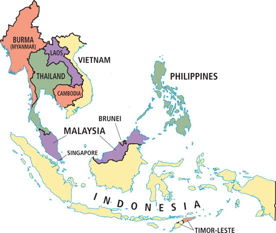
Many governments in Southeast Asia choose to dispense with place-
Another potential point of confusion is Borneo, a large island that is shared by three countries. The part of the island known as Kalimantan is part of Indonesia; while Sarawak and Sabah on the north coast are part of Malaysia; and Brunei is a very small, independent, oil-
THINGS TO REMEMBER
Indigenous land claims are no longer just local issues. Indigenous groups have shifted their efforts to secure their rights to ancestral lands to the global scale, highlighting a trend in which many issues that were once local or national are now becoming global concerns.