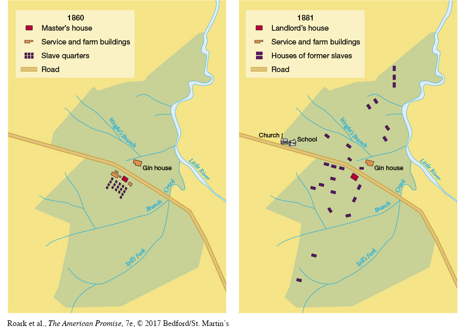
MAP ACTIVITYMap 16.1 A Southern Plantation in 1860 and 1881 These maps of the Barrow plantation in Georgia illustrate some of the ways in which ex- slaves expressed their freedom. Freedmen and freedwomen deserted the clustered living quarters behind the master’s house, scattered over the plantation, built family cabins, and farmed rented land. The former Barrow slaves also worked together to build a school and a church.READING THE MAP: Compare the number and size of the slave quarters in 1860 with the homes of the former slaves in 1881. How do they differ? Which buildings were prominently located along the road in 1860, and which could be found along the road in 1881?CONNECTIONS: How might the former master feel about the new configuration of buildings on the plantation in 1881? In what ways did the new system of sharecropping replicate the old system of plantation agriculture? In what ways was it different?