Map Activity 1 for Chapter 19

Printed Page 508 Chapter Chronology

Map Activity 1 for Chapter 19

image
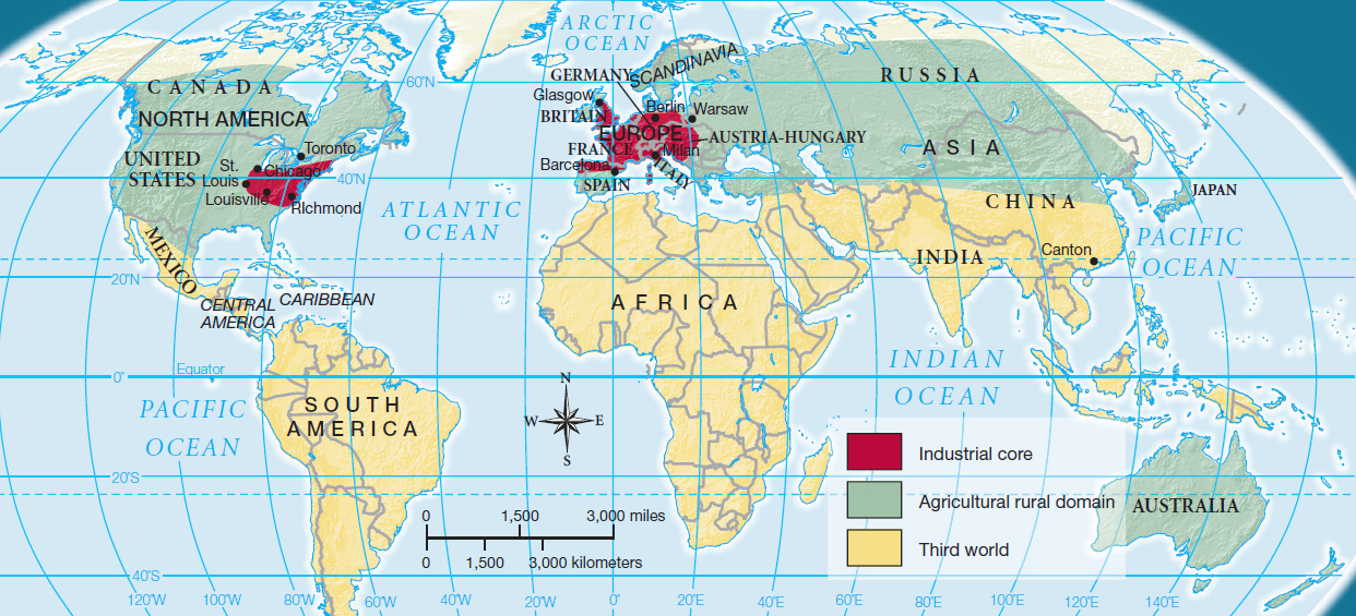
MAP 19.1 ECONOMIC REGIONS OF THE WORLD, 1890S
The global nature of the world economy at the turn of the twentieth century is indicated by three interconnected geographic regions. At the center stands the industrial core — western Europe and the northeastern United States. The second region — the agricultural periphery — supplied immigrant laborers to the industries in the core. Beyond these two regions lay a vast area tied economically to the industrial core by colonialism.

Question 19.1

+HgdHGiYAjHSMGYKpmrIgOmYHNXde4qVd3XyRpWam6wwtzonS07bWowwQ1nzI4Ly6TnaxKxoAMwISm4bpXcoTdhdfYR3qRqJn/Z5YyDBSpwAgaxd8+VZl/YwoEl2yJZ77OdWAtwUrNWlXTnTeU8rA5wTGPYnYA67qBk4BHKm5aLjQFqalNLZxAix2NxUlWdPlBa/bKUs2B3UiNkKSJ03kLI8WFf8uDW1KnAmgldEPkjfjMR4HH6/wYhzEXBPVdpiO/Eos9yuzyUEKH8lB4OVSjiozweJBM6mQ4i9zuTyCgdHw+quCa030DSaxJo9H0Rwg5ZqB03v5Z+0VUObnLNpfHdKz0SLHpPnsRGpNdfxDYcmvMcOOjYXnzzDUD5w0LtA3as+VzME11pJ06UANCvQLhdugdArmE6e

Question

tzKx/GUhyIpCYh0FfStLOT21/so0f3UOga+AsxBnq3WRwF6ph2+fBleA3Xik1gUMN3zsfWFAsEWhtIRVa4ynxYPKyCBIZQyrZaQZxSOKJD3Xo8aOK4gaQle/CGGaGYHCgmIcbHSBzoEEa7Xee5bC++UZ271fBJ8BX24uqjiZiK99gvOpLVZKr4OBLtrDlsHC2ZdEB32GhqX7xXL+0oc/anNXcnwFCdt5eUU9ZU3shGRKR31qho8LHyqi17xqies+1O9rCNKM0lnIG8RFvAd/ChYTLNm4S5gMOM7MMxhEDSJlMqgZWVpLW81/RnvZZlQM3eB6y/fvSb8=