5.4.3 Map Activity 1 for Chapter 5
Printed Page 107 Chapter Chronology
Map Activity
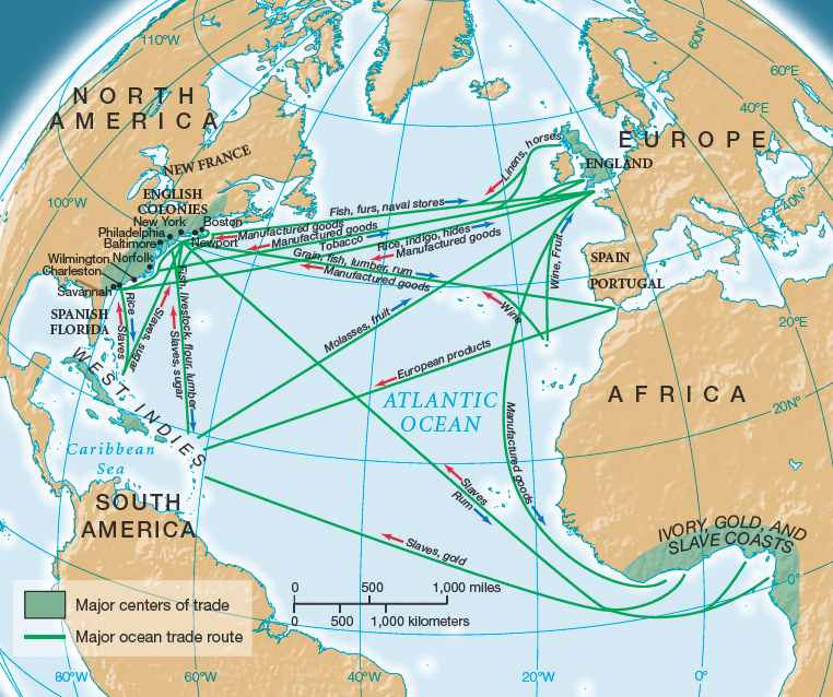
MAP 5.2 ATLANTIC TRADE IN THE EIGHTEENTH CENTURY
This map illustrates the economic outlook of the colonies in the eighteenth century—east toward the Atlantic world rather than west toward the interior of North America. The long distances involved in the Atlantic trade and the uncertainties of ocean travel suggest the difficulties Britain experienced governing the colonies and regulating colonial commerce.
Question 5.1
READING THE MAP: What were the major markets for trade coming out of Europe? What goods did the British colonies import and export?
Question 5.2
CONNECTIONS: In what ways did the flow of raw materials from the colonies affect British industry? How did British colonial trade policies influence the Atlantic trade?