Map Activity 2 for Chapter 9
Map Activity
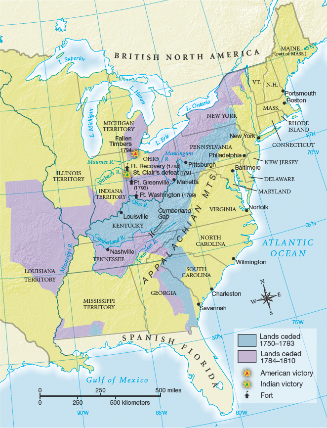
Figure 9.15: MAP 9.2 WESTERN EXPANSION AND INDIAN LAND CESSIONS TO 1810
Figure 9.15: By the first decade of the nineteenth century, intense Indian wars had resulted in significant cessions of land to the U.S. government by treaty.
Question 9.4
READING THE MAP: Locate the Appalachians. The Proclamation Line of 1763 that ran along these mountains forbade colonists to settle west of the line. How well was that purpose met?
Question 9.5
CONNECTIONS: How much did the population of the United States grow between 1750 and 1790? How did this growth affect western settlement?