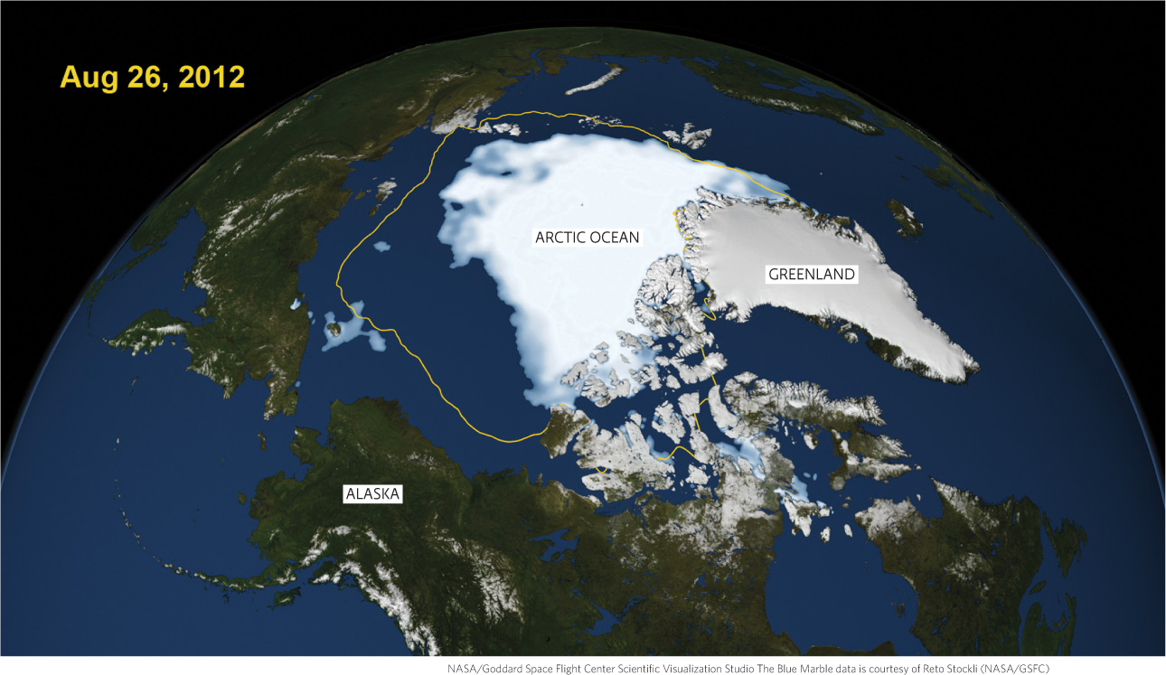
NASA satellite data reveals that 2012’s minimum sea ice extent in the Arctic Ocean, reached on August 26, 2012 as depicted here, was far smaller than the 30-year average (in yellow) and is part of an emerging trend. The lowest ice extents were recorded between 2007 and 2012, with 2012 being the lowest in recorded history (very high confidence.)
NASA/Goddard Space Flight Center Scientific Visualization Studio The Blue Marble data is courtesy of Reto Stockli (NASA/GSFC)