The source of pollution can be hard to pinpoint.
The entire Mississippi River watershed drains into the Gulf of Mexico. A watershed is simply an area of land over which rain and other sources of water flow to drain into a given river, lake, or stream. It includes all the smaller streams that empty into the river and their drainage areas. INFOGRAPHIC 15.3
Anything that happens in the watershed can potentially affect the quality of a body of water as well as the quantity of groundwater. This is especially important in terms of nonpoint source pollution that originates on land. Mapping the watershed is an important tool in watershed management. Here the watershed of this river and coastal area is outlined as a black dashed line.
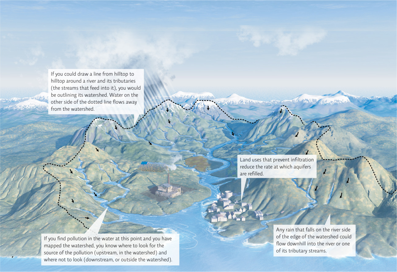

Suppose you discover that the stream by your house appears to be polluted (i.e., unusual smell, lots of dead fish, noticeable pollution, etc.). Why might it be helpful to have mapped the watershed of this stream?
This tells you where to look for the source of the pollution -- upstream in the watershed of your stream. There is no point in looking outside of the watershed area and no point in looking downstream for the source. (This won't help you with airborne "fallout" pollution, but it will help with land or water based sources.)
watershed
The land area surrounding a body of water over which water such as rain can flow and potentially enter that body of water.
The watershed feeding the Gulf of Mexico stretches well past the Louisiana basin and the Mississippi delta. It stretches all the way up to the northernmost reaches of the continental United States. Indeed, to glimpse the causes of—and possible solutions to—the hypoxia uncovered by Rabalais and Turner, we must travel to Minnesota, where the Mississippi River begins.
It’s tough to imagine that the homesteads of the far north—a place of corn fields and dairy farms—have anything to do with the rollicking backwater swamps of Louisiana. But it is here, along the tributaries that feed the nation’s farmlands, that our story truly begins. “The nitrogen that’s killing the Gulf starts here, gets added to the ecosystem here, in these farms and fields,” says Alex Echols, former head of the U.S. Fish and Wildlife Service and a consultant to the Minnesota-based Sand County Foundation (an environmental group). “This is where it’s all coming from.”
Echols likes to think of nitrogen and phosphorus as characters in a story. “Nitrogen is like a big healthy [college] boy,” he says. “He’s smart and he’s got potential. If we set him on the right path, he can grow the world green and make it better. But it’s easier and more fun for him to slip on down to Louisiana and party.” Phosphorus is a bit of a follower: It generally stays bound up in the soil but can also be carried away when that soil starts to move.
KEY CONCEPT 15.4
Land uses that decrease runoff and increase infiltration help to recharge aquifers because the water soaks into the ground rather than reaching the nearest surface water as runoff.
The route that this “college boy” travels is well mapped. In fact, a variety of experiments have shown how water flows through a watershed’s plants, soils, and streams. It turns out that while runoff pollution can directly affect surface water quality by delivering pollutants, it also impacts the quantity of groundwater. When it rains, some rainfall soaks into the soil, infiltrating the ground below; some eventually reaches groundwater in the aquifer, which people can tap into to create a well. If the groundwater is deep enough, infiltration can act as a filtering system that purifies the water. However, if the water table is close to the surface, pollutants can still make it all the way to groundwater; for example, nitrate pollution from fertilizer runoff can contaminate well water enough to be life threatening, especially to young children. (For more on aquifers, freshwater, and the water cycle, see Chapter 14.)
aquifer
An underground, permeable region of soil or rock that is saturated with water.
But human land uses have altered the way water drains through watersheds and waterways. Pavement and even suburban lawns enhance runoff by preventing water from soaking into the ground, reducing the rate at which aquifers are refilled; they can be rapidly depleted if we remove well water faster than it is replaced. Many meandering waterways have been channelized (made straight) to divert water toward or away from land areas as needed. Wetlands, too, have been completely drained to allow urban or suburban development or for agriculture. These activities also speed the flow of water across and out of a watershed, decreasing infiltration and bringing with the water whatever industrial, agricultural, or municipal pollutants it encounters on its trip downhill. In the Mississippi River watershed, this includes runoff pollution from roadways, urban areas, and industries throughout the region, as well as animal waste and excess fertilizer from hundreds of thousands of acres of farmland.
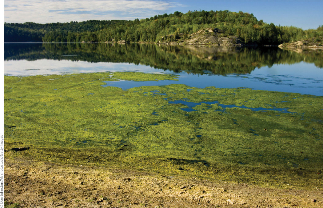
In all, some 1.5 million metric tons of nitrogen and phosphorus now flow through the Mississippi River watershed and into the Gulf of Mexico every year. And the Gulf is not the only body of water so beset. According to the United Nations, nutrient pollution is the leading type of water pollution worldwide. And according to a 2008 study, hypoxic zones now plague more than 400 systems and affect more than 245,000 square kilometers (95,000 square miles) of water around the world. “They are for sure a leading source of trouble for marine ecosystems globally,” says Robert Diaz, a researcher at the Virginia Institute of Marine Sciences and the study’s lead author. Of those 400 hypoxic zones, 166 are located in the United States.
“We have far more nitrogen moving off the landscape than we did historically,” Echols says. “And there are three main reasons for that.” The first is that we’ve changed what we grow—from foods like alfalfa and oats that don’t leak much nitrogen, to foods like soybeans and corn that do release lots of nitrogen back into the soil. The second is the rampant increase in the use of synthetic nitrogen for fertilizer throughout the modern agricultural era. “That’s not necessarily a bad thing,” Echols says. “There are certainly benefits to the way we’ve increased productivity; but those pluses come with minuses and this is a huge, huge minus.” Synthetic fertilizers, combined with atmospheric byproducts of fossil fuel burning, have essentially doubled the amount of usable nitrogen in the environment.
KEY CONCEPT 15.5
Nutrient pollution is a serious problem for surface waters in some areas. Reducing overall fertilizer use and taking steps to reduce runoff and erosion can reduce this pollution.
But the most interesting cause of nitrogen increases, Echols says, is this: We have massively replumbed the natural hydrology of our watersheds. To be sure, there were good reasons for this. A lot of our prime agricultural land is not exactly prime; it’s too wet in the spring, which means that seeds would rot rather than grow were it not for some feats of engineering that drain the subsurface water out of the soil. Drainage systems enable farmers to get the crop in earlier and to guard against crop losses during flooding. Saturated ground does not soak up any rainfall; rather, the rain runs off the surface. Drainage systems reduce surface runoff, which in turn prevents the loss of sediment and thus of phosphorus (because, remember, phosphorus is bound up in the soil).
“By installing a drainage system, you can increase the land’s productivity by 20–30 percent,” Echols says. “That means more food for people to eat, and more income for farmers. But at the same time you’ve just established a very efficient mechanism for moving water off the field, and keep in mind, nitrogen is water soluble. Water is its ticket down to the party in Louisiana.” And those drainage pipes (commonly called “tile lines” because they were originally made of short, perforated clay pipes known as tiles) end up being its passageway.
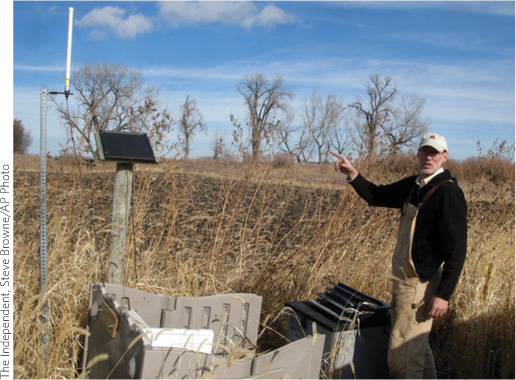
Echols and others say that tile lines may also be our passageway—to addressing the problem of nutrient runoff. “It’s going to take huge, tectonic shifts—in federal policies, and in the global food economy, and even in the culture—to move farmers off corn and soybean; to move them off synthetic fertilizers; to move them off fossil fuels,” Echols says. “But managing the tile lines? We can do that. We can do that farm by farm.”