How big is the Atlantic Garbage Patch, and is it growing?
The first garbage patch was discovered in 1997 by Captain Charles Moore, a veteran seafarer who was crossing the Pacific on his way back from an international yacht race.
As the press caught wind of what sounded like a giant plastic island in the middle of the ocean, a media frenzy ensued. Some reports said the patch was twice the size of Texas; others claimed that the patch was growing exponentially. But these widely reported claims were misleading, if not downright wrong.
Part of the trouble was semantic. “An oceanographer understands the term ‘patch’ to mean ‘an uneven distribution,’” says Kara Law, a scientist at the Woods Hole Oceanographic Institute who has led several expeditions on the Corwith Cramer. “We say the upper ocean is ‘patchy’ because organisms are often observed in clumps, separated by regions with sparse populations. But when reporters and laypeople hear ‘patch,’ they incorrectly think of an ‘island’ or a ‘continent’ of trash.”
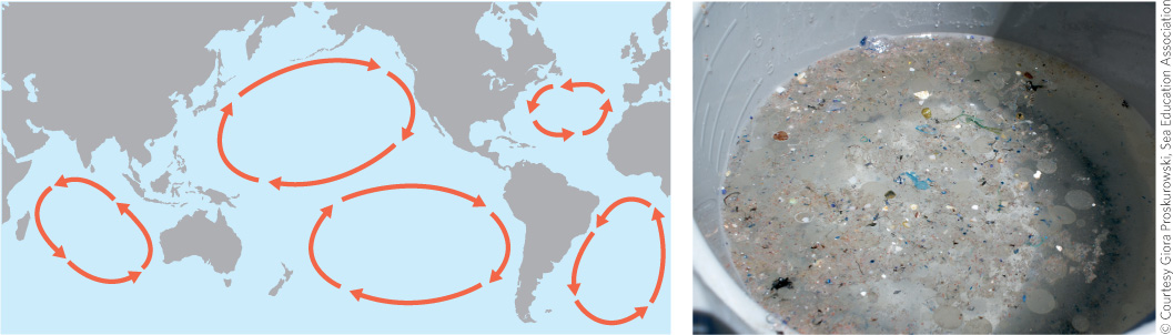
A bigger problem was the data itself. MSW and global plastic production data indicated that more plastic was being produced, used, and discarded throughout the world. According to one scientific study, the amount of plastic being ingested by Subarctic seabirds had nearly doubled between 1975 and 1985. But it was impossible to tell whether the patches themselves were growing. Data from the Pacific Patch suggested that the concentration of plastic had risen by an order of magnitude between the 1980s and 1990s. But that comparison was of limited value because sampling methods differed widely from one expedition to the next. In the Atlantic, where sampling methods had remained consistent across the years, no such increase could be detected.
Some scientists had suggested that the nets used on most plastics expeditions were too porous to trap the smallest of particles and that, with finer nets, much more plastic would be found at the surface. Others thought that plastic was hiding below the surface, throughout the mixed layer—a layer of uniform density at the top of the water column that is saturated with sunlight, low in nutrients, and easily mixed by wind. Part of the Corwith Cramer’s mission was to try and figure out which hypothesis might be correct.
By July 3, Proskurowski’s team had gleaned at least part of the answer. In the ship’s daily blog, he wrote:
The results from the past several days of tucker trawls [which collect water samples from discrete depths within the mixed layer] have been very interesting. While we’ve seen fairly low numbers of plastic at the surface, we have observed an almost equal amount of plastic from one meter’s water depth, slightly less at ten meters and no plastic below the mixed layer. These tows show that plastic is undoubtedly being mixed down into the water column, and what we measure at the surface is, in many cases, not the sum total of what is out here. Like many environmental problems, the closer you look at the system, the worse it appears.
It would be a few more weeks before they found out just how much worse.