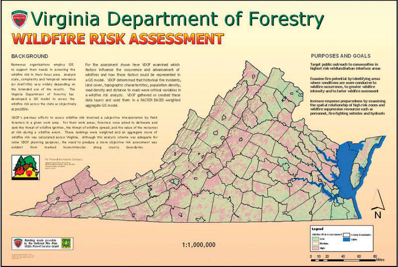
FIGURE 1.4
Geospatial technology used for assessing the risk of wildfires in Virginia.
(Source: Courtesy Virginia Department of Forestry)