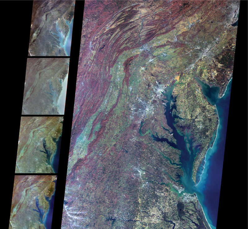
FIGURE 12.3 The operation of Terra’s MISR instrument, showing the Appalachian Mountains, Chesapeake Bay, and Delaware Bay as captured from looking straight down (on the right) and from a variety of other angles (the four images on the left).
(Source: NASA/GSFC/JPL, MISR Science Team)