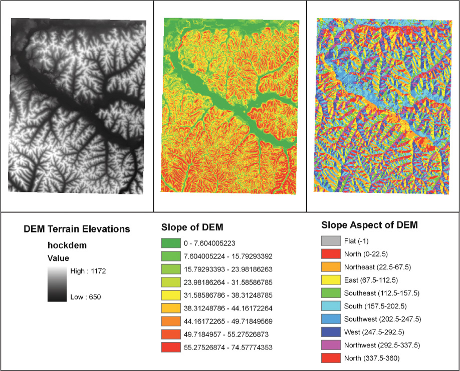
FIGURE 13.7
A USGS DEM of a portion of the Laurelville/Hocking region of Ohio and the slope and slope aspect grids derived from it.
(Source: USGS/Esri)