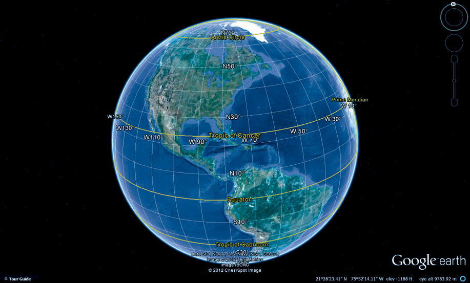
FIGURE 2.2
The geographic coordinate system (GCS) covers the globe, and locations are measured using latitude and longitude.
(Source: 2012 Google. Data SIO, NOAA, U.S. Navy, NGA, GEBCO. Image 2012 TerraMetrics, Image IBCAO, 2012 Cnes/Spot Image)