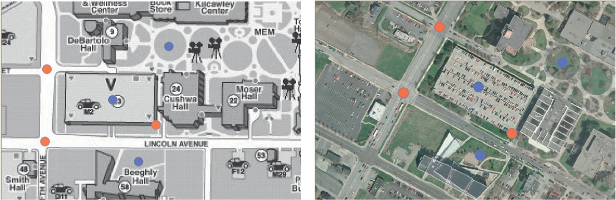
FIGURE 3.4
Good (in red) and poor (in blue) locations for control point selection.
(Source: Mahoning County Enterprise GIS/Esri)