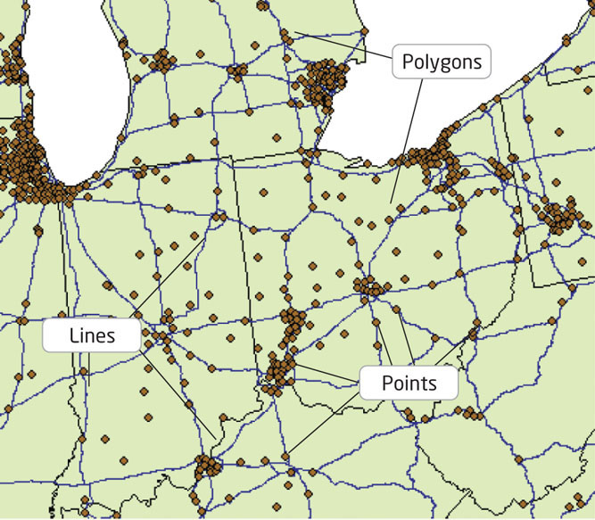
FIGURE 5.3
Points (city locations), lines (interstates), and polygons (state borders) as represented in GIS.
(Source: Esri)