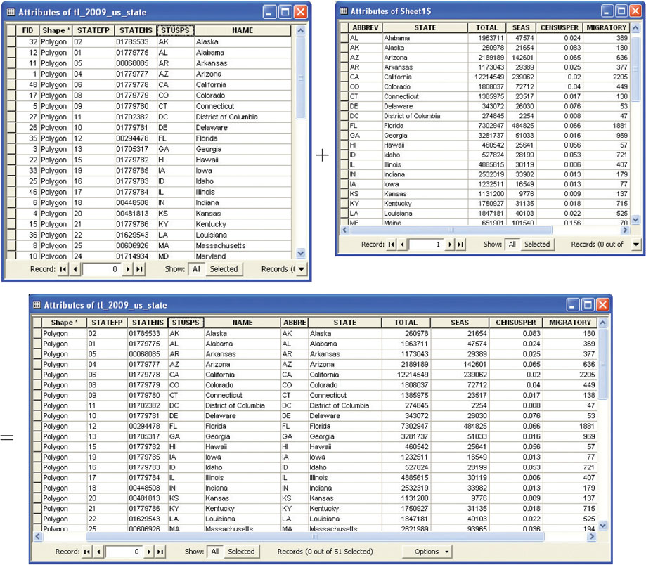
FIGURE 5.9
A joining of two attribute tables, based on their common field (the state’s abbreviation attribute).
(Source: Esri)