15.4 
How Is Geospatial Technology Used in K–12 Educational Efforts?
Groups such as NCGE, OhioView, and AmericaView are dedicated to promoting education in the ever-growing field of geospatial technology, but especially in K–12 classrooms. With geospatial technologies becoming increasingly utilized in today’s society, introducing concepts early in the grammar-school classroom and using them for illustrating topics such as geography, spatial thinking, or earth science is becoming increasingly common. These efforts are aided by the increasing availability of free software programs (like those used in this book), and plenty of freely available geospatial data. Remotely sensed images from the Earth Observing System (EOS) can help to provide clear, graphic explanations of environmental or climatic conditions, such as changing global temperatures, while easily comprehensible Landsat imagery can be used to evaluate the health of vegetation or the loss of forested lands (and to calculate the subsequent effects). NASA and Google have released teacher kits and supplemental lesson plans to accompany their products, and many other examples of geospatial technology being integrated into K–12 curricula can be found on the Internet and in our schools (see Hands-on Application 15.8: Educational Resources and Lesson Plans for several examples).
 HANDS-ON APPLICATION 15.8
Educational Resources and Lesson Plans
The widespread nature of geospatial technologies and the availability and access to geospatial software have allowed educators to integrate GIS, GPS, and remote sensing into lesson plans in multiple ways. Examine some of the following examples to see how geospatial technology is being incorporated into K–12 curricula.
- Educaching—GPS lesson plans: http://www.educaching.com
- GIS 2 GPS—GIS and GPS lesson plans: http://gis2gps.com
- Google Earth for Educators—Using Google Earth in the classroom: http://sitescontent.google.com/google-earth-for-educators
- Integrated Geospatial Education and Technology Training (IGETT)—Labs and other educational materials for GIS and remote sensing: http://igett.delmar.edu/index.html
- Juicy Geography—Lesson plans and ideas related to geospatial technology: http://www.juicygeography.co.uk
- NASA’s Teacher’s Kit—For use with Landsat 7 imagery: http://landsat.gsfc.nasa.gov/education/teacherkit
- NASA Teacher’s Guide—Using the Image Composite Explorer in the classroom: http://earthobservatory.nasa.gov/Experiments/ICE/ice_teacher_guide.php
- Sciencespot—GPS lesson plans: http://sciencespot.net/Pages/classgpslsn.html
- VirginiaView Educational Resources—Lesson plans incorporating remote sensing concepts and trackable geocoins: http://virginiaview.cnre.vt.edu/education.html
Expansion Questions:

Question
What kinds of activities are teachers using in the classroom that involve geospatial technology?
-
Question
When you’ve examined these examples, fire up a search engine and locate some other examples of how geospatial technologies are being applied in the classroom. What other types of activities and lesson plans are being used in classroom settings?
495
Geographic Alliance Network a National Geographic-sponsored organization set up in each state to promote geographic education
Beyond using Google Earth (and other software) for interactive classroom investigations, many other programs exist that are aimed at promoting geospatial technology at the K–12 level. The National Council for Geographic Education (NCGE) is at the forefront of geographic education, supporting teachers and furthering the understanding of geographic concepts at the K–12 level. Another organization dedicated to promoting geographic education is the Geographic Alliance Network, a national organization of geography educators at the K–12 and higher-education levels. Geographic Alliances are set up in each state as a way of hosting workshops, professional development, meetings, events, involvement with Geography Bees, lesson plans, and more at the statewide level.
496
SATELLITES Students and Teachers Exploring Local Landscapes to Interpret the Earth from Space—an OhioView initiative involving K–12 teachers and students with geospatial technologies
Among OhioView’s initiatives is SATELLITES (Students and Teachers Exploring Local Landscapes to Interpret the Earth from Space), a program designed to instruct K–12 teachers about geospatial technologies and to help them to introduce them into their classrooms. SATELLITES hosts week-long “teachers’ institutes” during the summer (in locations in Ohio). These institutes are free for teachers to attend (and teachers can earn free graduate credits, when available, through successful participation). During the week, teachers receive introductory instruction in several of this book’s topics (including GIS, GPS, remote sensing, landscapes, and how to use remotely sensed environment and climate data) and participate in hands-on work with the technology itself. Teachers also receive free equipment to take back to their classrooms, including a GPS receiver and an infrared thermometer. The aim is for the teachers to develop a research project which will incorporate geospatial technologies and an environmental theme (previous SATELLITES institutes have engaged with global research initiatives like the International Polar Year).
An example of a SATELLITES success story is the “Satellite Girls” (a group of four middle school students from Akron, Ohio). Their teacher attended the SATELLITES program in the summer of 2007 and involved a group of his students with data collection and analysis through GLOBE. The girls competed with their project at state and national levels, and were selected to be one of five teams of students to represent the United States at the international GLOBE Learning Expedition in Cape Town, South Africa, in 2008. In 2010 and 2012, GLOBE projects developed by students as a result of their teachers’ participation in the SATELLITES program were presented by the students at the White House Science Fair in Washington, D.C.
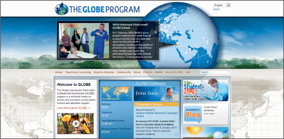
GLOBE Global Learning and Observations to Benefit the Environment—an education program aimed at incorporating user-generated environmental data observations from around the world
The inquiry-based projects the K–12 students become involved with are part of GLOBE (Global Learning and Observations to Benefit the Environment), an international initiative sponsored by NASA and NOAA that incorporates over 20,000 schools from 114 countries. GLOBE is dedicated to the study of Earth’s environments and ecosystems (Figure 15.7). Using specific data-collection protocols, students involved with GLOBE collect data related to land cover, temperature, water, soils, and the atmosphere. This data is shared with other students around the world via the GLOBE Website, creating rich and far-ranging datasets for use by everyone. Teachers attending the SATELLITES institutes learn GLOBE protocols and engage their students through field data collection coupled with geospatial technology applications.
497