1.5 
What Is Google Earth?
Google Earth a freely available virtual globe program first released in 2005 by Google
virtual globe a software program that provides an interactive three-dimensional map of Earth
geotag connecting a photo to a real-world location
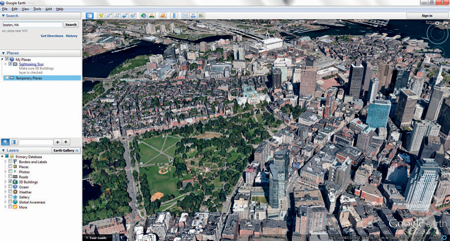
An example of a widespread geospatial technology application is the popular Google Earth software program. Google Earth is a virtual globe—a program that provides an interactive three-dimensional (3D) representation of Earth. Google Earth brings together several aspects of geospatial technology into one easy-to-use program. You can examine satellite imagery or aerial photography of the entire globe, zoom from Earth’s orbit to a single street address, navigate through 3D cities or landscapes, measure global distances, and examine multiple layers of spatial data together, all with an intuitive interface. In many ways, the coolness and simplicity of Google Earth make it feel like a video game of geospatial technology, but it’s far more than that. Google Earth is able to handle vast amounts of geospatial data swiftly and easily, and it enables users to specify and create their own location-based spatial data (see Figure 1.9 for a look at Google Earth and some of its layers). For instance, Google Earth works with Google’s Picasa program to give you the capability to geotag photos that you take. When photos are geotagged, they are connected to a geospatial location—so by clicking on a geotagged location in Google Earth, you can view a photo taken at that spot.
15
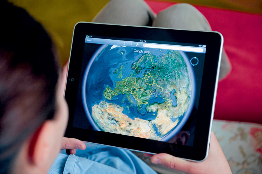
Before Google Earth, there was Keyhole’s Earth Viewer, a program that enabled you to fly across a virtual Earth, zooming in and out of locations and imagery. Google purchased the Keyhole company, and the first version of Google Earth was released in 2005. Google Earth is freely available for download off the Web, and relies on a high-speed Internet connection to send the data from Google servers to your computer. For instance, when you use Google Earth to fly from space to your house, the imagery you see on the screen is being streamed across the Internet to you. The imagery on Google Earth is “canned,” that’s to say, it’s fixed from one moment in time, rather than being a live view. For instance, if the imagery of your house used by Google was obtained in 2005, then that’s the snapshot in time you’ll be viewing, rather than a current image of your house. However, Google Earth has a feature that enables you to examine past images. For instance, if imagery of your town was available in 2006, 2008, and is today, you can choose which of these images you want to view. Many other data layers have been up dated and are constantly being added, such as 3D buildings and other location-based application layers. Also, like many other geospatial technologies, Google Earth can be accessed as an app on mobile devices, like smartphones and tablets (see Figure 1.10).
16
 THINKING CRITICALLY WITH
GEOSPATIAL TECHNOLOGY 1.1
What Happens to Privacy in a Geospatial World?
Think about this scenario. If you own property (house or business), then that information is part of the public record with the county auditor’s office, and likely available online. Someone can type your address into an online GIS (or mapping Website such as MapQuest or Google Maps) and get a map showing how to travel to your property. In addition, the dimensions, boundaries, and a high-resolution image of your property can be easily obtained. It is possible that other information can be acquired, such as a close-up photo of your house taken from the street. All of this is free, publicly available information that can be had with just a few clicks of a mouse. Anonymity about where you live or work is suddenly becoming a thing of the past. What does the widespread availability (and access to) this type of spatial information mean with regard to privacy? If anyone with an Internet connection can obtain a detailed image of the house you live in, has your personal privacy been invaded?
The Geospatial Lab Application 1.1: Introduction to Geospatial Concepts and Google Earth that accompanies this chapter walks you through several different ways of utilizing Google Earth. It assumes no prior experience with Google Earth, but even veteran users may find some new tricks or twists in how geospatial data is handled. You’ll use a variety of Google Earth tools to investigate several of the avenues this book will explore, from aerial image interpretation and 3D representations of terrain and objects to ways of determining the shortest path between two destinations. Before you start using Google Earth, Hands-on Application 1.8: The Google Earth Plug-In will show you some of its very cool features and applications just using your Web browser.
17
 HANDS-ON APPLICATION 1.8
The Google Earth Plug-In
The Google Earth Plug-in is a special add-on that will install into your Web browser and allow you to utilize Google Earth features via the Web. Open your Web browser, go to http://www.google.com/earth/explore/products/plugin.html, and follow the instructions for installing the Google Earth Plug-in for your Web browser. When it’s installed, you’ll see a preview window that will allow you to rotate, zoom, and tilt a virtual globe of Earth.
The Website will also give links to several examples of how the plug-in is used for a variety of geospatial applications accessible just through your web browser. For instance, the Driving Simulator link (also available at http://earth-api-samples.googlecode.com/svn/trunk/demos/drive-simulator/index.html) will allow you to follow a car along a driving route through the 3D environs of Google Earth. Check out this simulator, and the other examples given on the Website.
Expansion Questions:

Question
What is the advantage of using Google Earth functions in a Web browser instead of having to download and install the software?
-
Question
What Google Earth functions are not available using only the plug-in?