3
Getting Your Data to Match the Map
58
Reprojecting, Georeferencing, Control Points, and Transformations
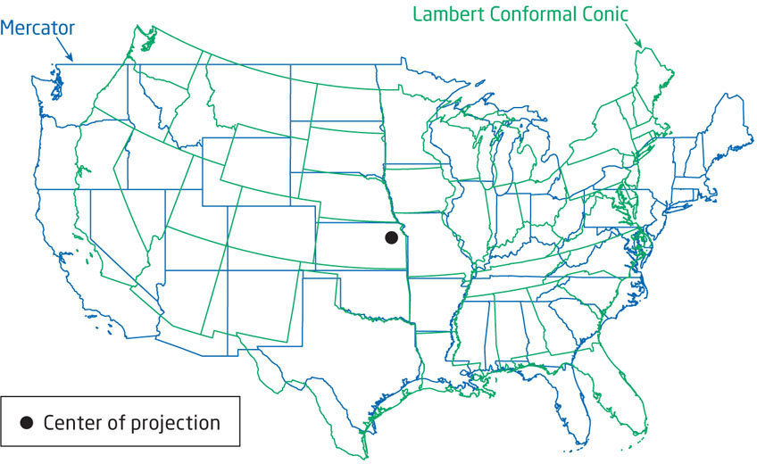
Since there are all of these datums and map projections out there, it’s important to know which one you’re using when you’re making measurements. Say, for instance, you have two sets of geospatial data about your town that you need to bring together for analysis on one map (that is, a street map with building footprints). Both of these pieces of data are in a different projection and coordinate system, and both use a different datum—the street map is in State Plane NAD27 feet and the buildings are in UTM NAD83 meters. When you put these things together, nothing is going to match up—the streets and buildings are going to be in different places in relation to each other since each one uses a different basis for its coordinates.
It’s important to note when you’re dealing with geospatial data that it can be constructed using a variety of different datums, coordinate systems, and projections. With all the different variations involved with these items, it’s best to try and work with all geospatial data on the same basis (that is, to use the same datum, coordinate system, and projection). If you have multiple data layers in different map projections and you try to overlay them, then those pieces of data won’t properly align with each other (Figure 3.1).