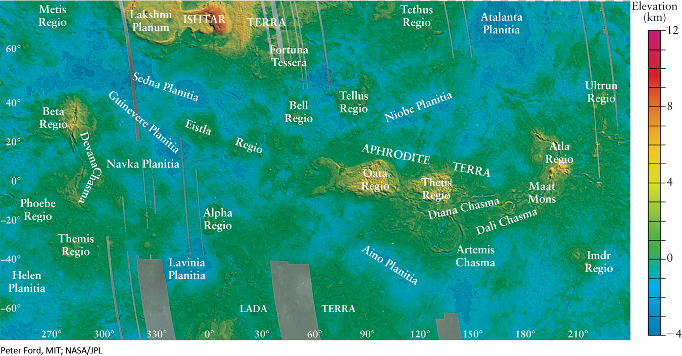
Figure 6-10 RIVUXG Topographic Map of Venus Radar altimeter measurements by Magellan were used to produce this topographic map of Venus. Color indicates elevations above (positive numbers) or below (negative numbers) the planet’s average radius. (The blue areas are not oceans!) Gray areas were not mapped by Magellan. Flat plains of volcanic origin cover most of the planet’s surface, with only a few continentlike highlands.