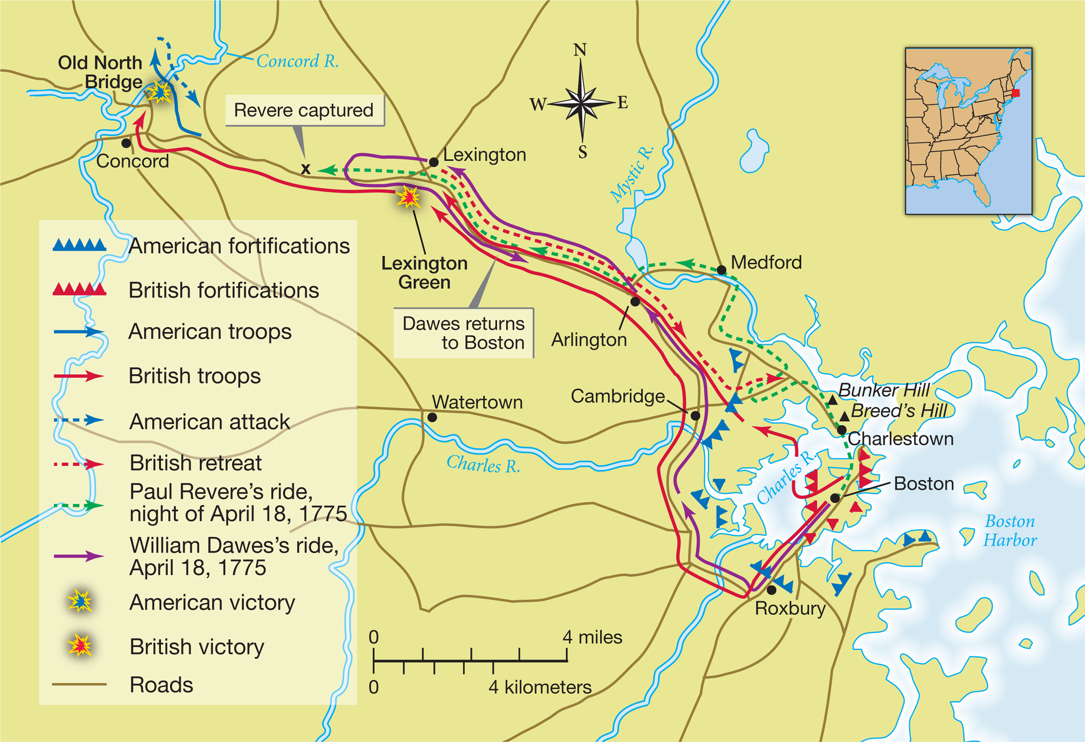
MAP ACTIVITY MAP 6.3 Lexington and Concord, April 1775 Two Americans slipped out of Boston to warn of a surprise British attack on Concord. Paul Revere went by boat to Charlestown and then by horse to Lexington, while William Dawes casually rode past British sentries and then galloped at full speed through Lexington to Concord. READING THE MAP: How did Dawes’s route differ from Revere’s? What kinds of terrain and potential dangers did each man face during his ride, according to the map? CONNECTIONS: Why send two men on the same mission? Why not send four or more?