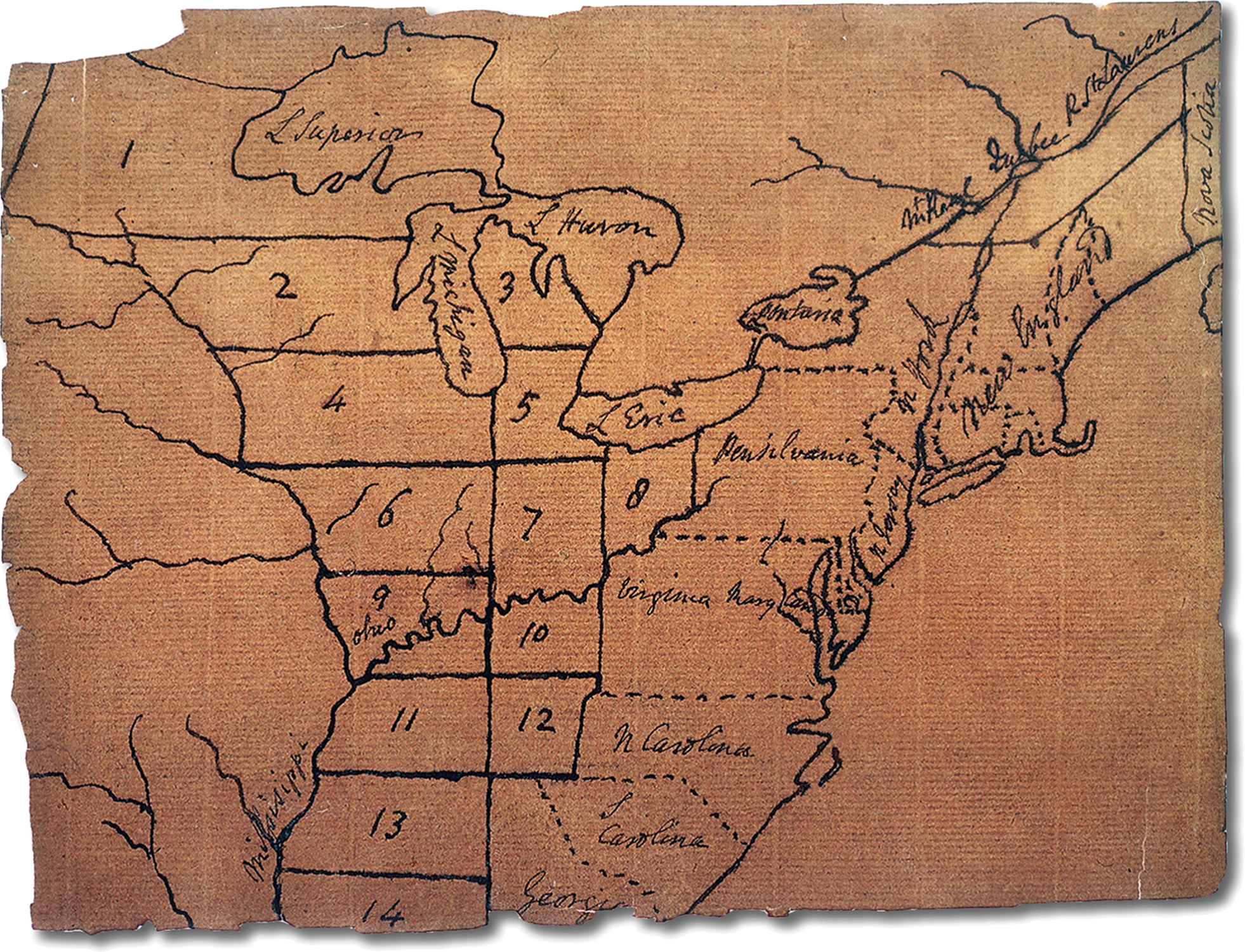
VISUAL ACTIVITY Jefferson’s Map of the Northwest Territory Thomas Jefferson proposed nine states in his initial plan for the Northwest Territory in 1784. Straight lines and right angles held a strong appeal for him. But such regularity ignored inconvenient geographic features such as rivers and even more inconvenient political facts such as Indian territorial claims. William L. Clements Library, University of Michigan. READING THE IMAGE: What does this map indicate about Jefferson’s vision of the Northwest Territory? CONNECTIONS: What were the problems with Jefferson’s design for the division of the territory? Why did the congress alter it in the land ordinances of 1784, 1785, and 1787?