Tectonic Provinces Around the World
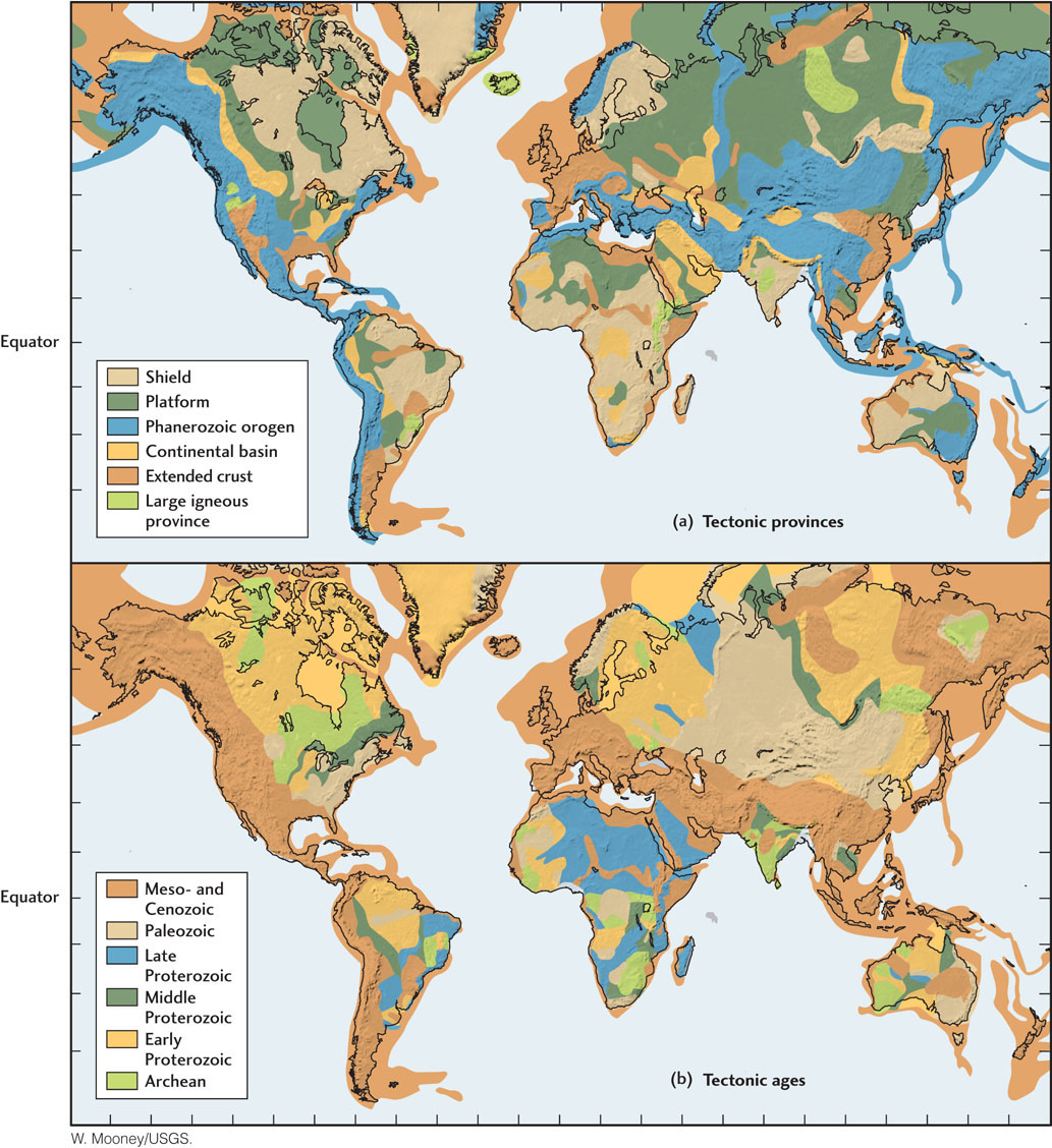
We will now expand our view from North America to Earth’s other continents. Each continent has its own distinctive features, but a general pattern becomes evident when continental geology is viewed on a global scale (Figure 10.8a). Continental shields and platforms make up the most stable parts of the continental lithosphere, called cratons, and contain the eroded remnants of ancient deformed rocks. The North American craton comprises the Canadian Shield and the interior platform (see Figure 10.1).

260
Around these cratons are elongated mountain belts, or orogens (from the Greek oros, meaning “mountain,” and gen, “be produced”), that were formed by later episodes of compressive deformation. The youngest orogenic (mountain-building) systems, such as the North American Cordillera, are found along the active margins of continents, where tectonic processes caused by plate movements continue to deform the continental crust.
The passive margins of continents—those that are attached to oceanic crust as part of the same plate and thus are not near plate boundaries—are zones of extended crust, stretched during the rifting that broke older continents apart and initiated seafloor spreading. This rifting often occurred parallel to older mountain belts, such as the Appalachian fold belt.
Types of Tectonic Provinces
The general pattern of cratons bounded by orogens can be seen in Figure 10.8a, which summarizes the major tectonic provinces of the continents worldwide. The classifications portrayed on this map are closely related to those we used to describe the tectonic provinces of North America:
 Shield. A region of uplifted and exposed crystalline basement rocks of Precambrian age, which have remained undeformed throughout the Phanerozoic eon (542 million years ago to the present). Example: Canadian Shield.
 Platform. A region where Precambrian basement rocks are overlain by less than a few kilometers of relatively flat-lying sediments. Examples: interior platform of central North America, Hudson Bay.
 Continental basin. A region of prolonged subsidence where thick sediments have accumulated during the Phanerozoic, with beds dipping into the center of the basin. Example: Michigan Basin.
 Phanerozoic orogen. A region where mountain building has occurred during the Phanerozoic. Examples: Appalachian fold belt, North American Cordillera.
 Extended crust. A region where the most recent deformation has involved large-scale crustal extension. Examples: Basin and Range province, Atlantic coastal plain.
261
Tectonic Ages
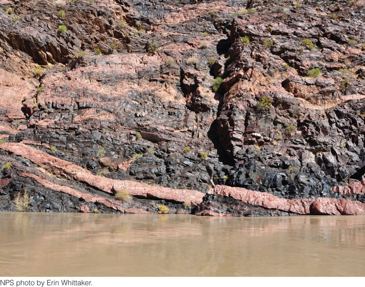
The tectonic age of a rock is the time of the last major episode of crustal deformation of that rock (Figure 10.8b). Most continental basement rocks have survived a long and complex history of repeated deformation, melting, and metamorphism. We can often use isotopic dating techniques and other age indicators (see Chapter 8) to extract more than one age to any particular rock. The tectonic age indicates the last time the isotopic clocks within a rock were reset by tectonic deformation and accompanying metamorphism of the upper crust. For example, many of the igneous rocks in the southwestern United States were originally derived from the melting of crust and mantle in the middle Proterozoic (1.9 billion to 1.6 billion years ago) (Figure 10.9). However, those rocks were substantially metamorphosed by subsequent tectonic activity, including several episodes of compressive deformation in the Mesozoic and rifting in the Cenozoic. Geologists thus assign this region to the youngest age category, Mesozoic-Cenozoic.

262
A Global Puzzle
The current distribution of continental tectonic provinces and their ages is like a giant puzzle in which the original pieces have been rearranged and reshaped by continental rifting, continental drift, and continent-continent collisions over billions of years. Only the past 200 million years of plate movements can be reliably determined from existing oceanic crust. Earlier plate movements must be inferred from the indirect evidence found in continental rocks. In Chapter 2, we saw that geologists have made amazing progress in reconstructing earlier configurations of the continents from paleomagnetic and paleoclimate data and from the signatures of deformation exposed in ancient mountain belts.
In the next section, we trace the history of the continents even further back into geologic time. Once again, we use the history of North America as our prime example, starting with its youngest provinces along its west coast and working backward in time to the Canadian Shield. We focus on three key questions about continental evolution: What geologic processes built the continents we see today? How do these processes fit into the theory of plate tectonics? Can plate tectonics explain the original formation of the cratons? As we will see, these questions have been only partially answered by geologic research.