Where Do Channels Begin? How Running Water Erodes Soil and Rock
Stream channels begin where rainwater, running off the surface of the land, flows so fast that it abrades the soil and bedrock and carves into it to form a gully (essentially a small valley). Once a gully forms, it captures more of the runoff, and thus the tendency of the stream to cut downward increases. As the gully progressively deepens, the rate of downcutting increases as more water is captured (Figure 18.11).
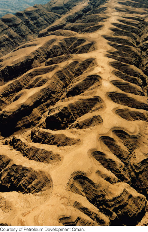
The erosion of unconsolidated material is relatively easy to observe. We can easily see a stream picking up loose sand from its bed and carrying it away. At high water levels and during floods, we can even see a stream scouring and cutting into its banks, which then slump into the flow and are carried away. Streams progressively cut their channels upstream into higher land. This process, called headward erosion, commonly accompanies widening and deepening of valleys. Its progress may be extremely rapid—as much as several meters in a few years in easily erodible soils. Downstream erosion is much less common and is best expressed in rare catastrophic events, such as when an earthquake collapses a natural dam and sends scouring waters plunging downstream.
508
We cannot so easily see the erosion of solid rock. Running water erodes solid rock by abrasion, by chemical and physical weathering, and by the undercutting action of currents.
Abrasion
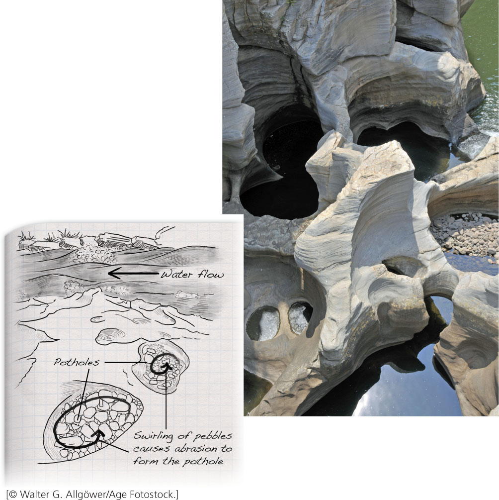
One of the major ways a stream breaks apart and erodes rock is by abrasion. The sand and pebbles the stream carries create a sandblasting action that wears away even the hardest rock. In some streambeds, pebbles and cobbles rotating inside swirling eddies grind deep potholes into the bedrock (Figure 18.12). At low water, pebbles and sand can be seen lying quietly at the bottom of exposed potholes.
Chemical and Physical Weathering
Chemical weathering breaks down rocks in streambeds just as it does on the land surface. Physical weathering in streams can be violent, as the crashes of boulders and the constant smaller impacts of pebbles and sand split rock along natural zones of weakness. Such impacts in a stream channel break up rock much faster than slow weathering on a gently sloping hillside does. When these processes have loosened large blocks of bedrock, strong upward eddies may pull them up and out in a sudden violent plucking action.
Physical weathering is particularly strong at rapids and waterfalls. Rapids are places in a stream where the flow velocity increases because the slope of the streambed suddenly steepens, typically at rocky ledges. The high speed and turbulence of the water quickly break rocks into smaller pieces that are carried away by the strong current.
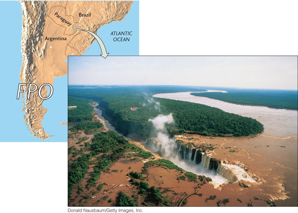
The Undercutting Action of Waterfalls
Waterfalls develop where hard rocks resist erosion or where faulting offsets the streambed. The tremendous impact of huge volumes of plunging water and tumbling boulders quickly erodes streambeds below waterfalls. Waterfalls also erode the underlying rock of the cliffs that form the falls. As erosion undercuts these cliffs, the upper streambed collapses, and the falls recede upstream (Figure 18.13). Erosion by falls is fastest where the rock layers are horizontal, with erosion-resistant rocks at the top and softer rocks, such as shales, making up the lower layers. Historical records show that the main section of Niagara Falls, perhaps the best-known falls in North America, has been moving upstream in this way at a rate of a meter per year.
509