Earth’s Shape and Surface
The scientific method has its roots in geodesy, a very old branch of Earth science that studies Earth’s shape and surface. The concept that Earth is spherical rather than flat was advanced by Greek and Indian philosophers around the sixth century b.c., and it was the basis of Aristotle’s theory of Earth put forward in his famous treatise, Meteorologica, published around 330 b.c. (the first Earth science textbook!). In the third century b.c., Eratosthenes used a clever experiment to measure Earth’s radius, which turned out to be 6370 km (see the Practicing Geology exercise at the end of the chapter).
9
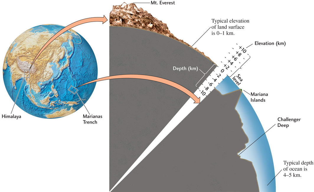
Much more precise measurements have shown that Earth is not a perfect sphere. Because of its daily rotation, it bulges out slightly at its equator and is slightly squashed at its poles. In addition, the smooth curvature of Earth’s surface is broken by mountains and valleys and other ups and downs. This topography is measured with respect to sea level, a smooth surface set at the average level of ocean water that conforms closely to the squashed spherical shape expected for the rotating Earth. Many features of geologic significance stand out in Earth’s topography (Figure 1.8). Its two largest features are continents, which have typical elevations of 0 to 1 km above sea level, and ocean basins, which have typical depths of 4 to 5 km below sea level. The elevation of Earth’s surface varies by nearly 20 km from its highest point (Mount Everest in the Himalaya at 8850 m above sea level) to its lowest point (Challenger Deep in the Marianas Trench in the Pacific Ocean at 11,030 m below sea level). Although the Himalaya may loom large to us, their elevation is a small fraction of Earth’s radius, only about one part in a thousand, which is why the globe looks like a smooth sphere when seen from outer space.